AccuWeather meteorologists are available 24/7 to provide further insights and updates on evolving weather conditions. Please contact pr@accuweather.com during regular business hours, or support@accuweather.com or call AccuWeather’s Media Hotline at (814)-235-8710 at any time to arrange interviews with AccuWeather experts or to request the most updated graphics for print or broadcast.
AccuWeather Forecasting a Tropical Storm to make landfall in North Carolina on Monday
Sept. 14, 2024
|
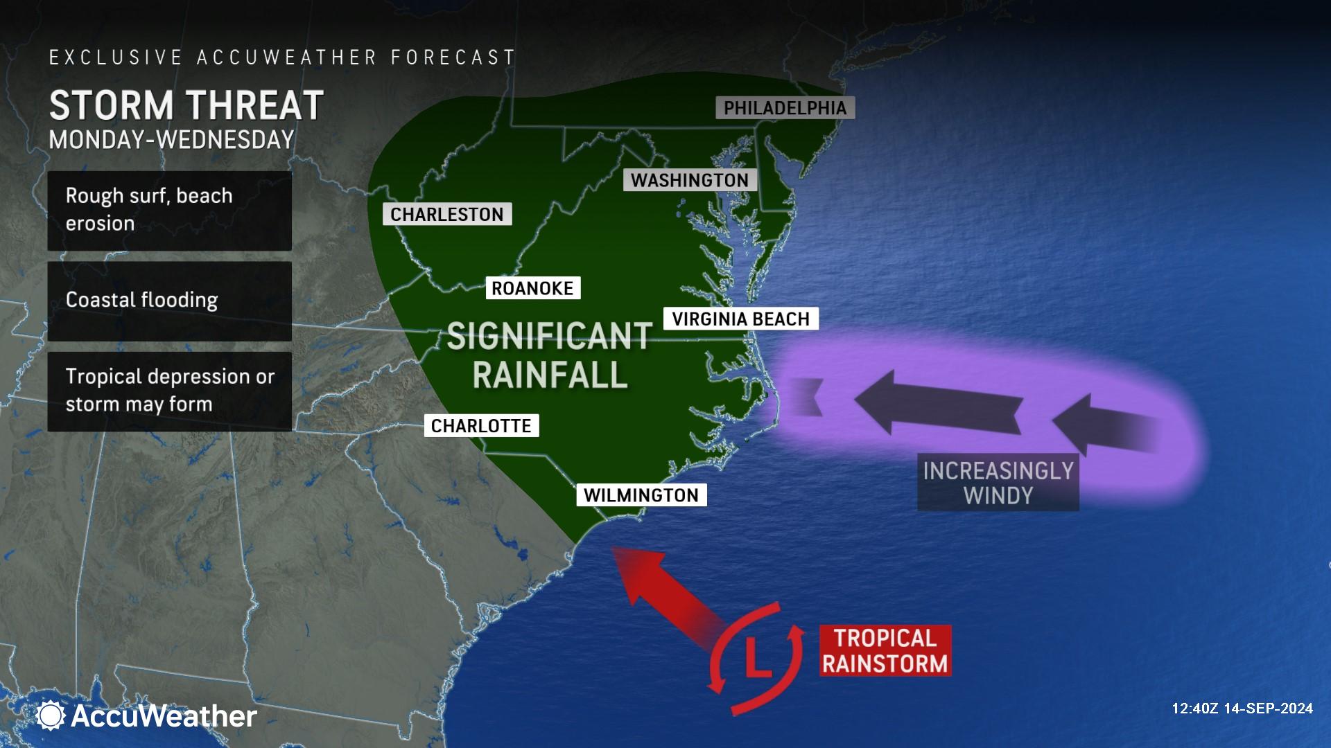
Families and businesses are being warned to prepare for drenching rainfall, powerful wind gusts, coastal flooding, beach erosion and the threat of isolated tornadoes early next week across parts of the southeast U.S. as an evolving storm develops over the weekend.
|
|||
AccuWeather Global Weather Center – Sept. 14, 2024
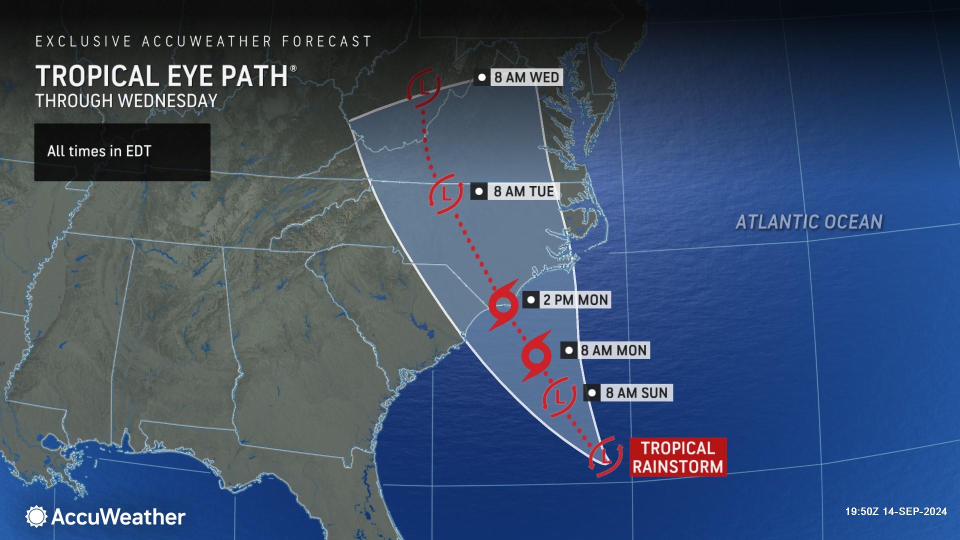
“Everyone across coastal North Carolina, southeast Virginia, and northeast South Carolina needs to be prepared for a stormy end to the weekend and a threat for flooding next week,” said AccuWeather Senior Meteorologist Alan Reppert. “Don’t wait to start preparing until this storm is named. We’re forecasting gusty winds that could reach 80 mph and flooding rainfall. We don’t want anyone to be caught off guard and unprepared, especially in areas that are prone to flash flooding and beach erosion, which could block roads.”
AccuWeather was the first known source to issue a forecast track for this evolving threat on Saturday afternoon to help families, businesses, emergency officials and government leaders better prepare for impacts. The next name on the list of tropical storms for the 2024 Atlantic hurricane season is Helene.
Rain and gusty winds are expected to arrive across eastern North Carolina by Sunday night. Reppert said parts of the North Carolina, South Carolina and Virginia coastline will likely be impacted with rough surf, beach erosion and dangerous rip currents through the weekend into early next week. Hazardous beach conditions from Delaware to Jacksonville, Florida, are possible through midweek.
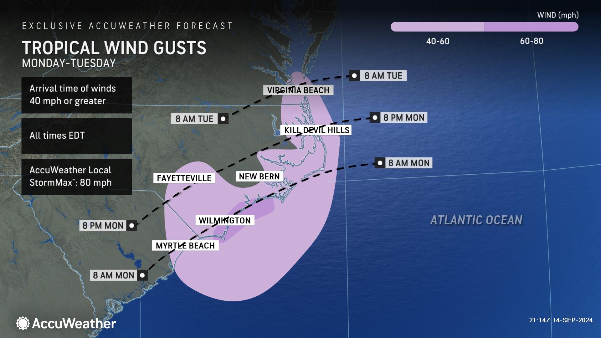
Widespread wind gusts of 40-60 miles per hour late Sunday into Monday across southeastern Virginia, eastern North Carolina and northeastern South Carolina are expected. Along the North Carolina coast, near and to the east of where the storm makes landfall, gusts of 60-70 mph with an AccuWeather Local StormMax™ of 80 mph could cause widespread power outages and significant damage to some buildings.
AccuWeather expert meteorologists say people along eastern North Carolina should also be prepared for the threat of isolated tornadoes as the storm pushes inland.
“Make sure to keep your cell phone charged to receive severe weather alerts. It’s important to take immediate action and get to shelter if a tornado warning is issued for your area as this storm blows through,” said Reppert. “Be prepared for the possibility of extended power outages. It’s a good time to check your flashlight batteries and make sure any hurricane kit supplies used during Debby are restocked.”
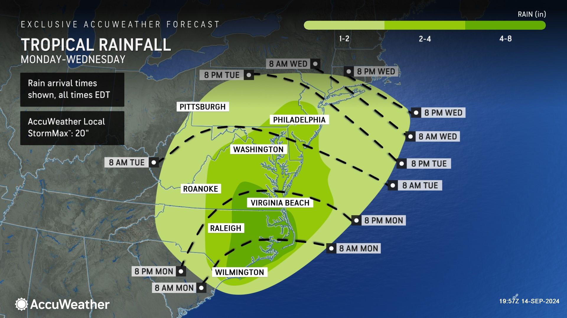
Widespread rain amounts of 4-8 inches are expected across eastern North Carolina and southeast Virginia, with an AccuWeather Local StormMax™ of 20 inches.
“There has been ample rain over the past month and a half across parts of the Carolinas,” said Reppert. “This developing storm could cause more flooding problems. It’s important that drivers never try to navigate through flooded roads. Turn around, don’t drown. Most swift water rescues and fatalities during tropical storms and hurricanes involve people trying to drive down flooded roads.”
Reppert said 2-4 inches of rainfall is expected in central Virginia and 1-2 inches of rainfall could soak much of West Virginia and parts of southwest Virginia.
“The rain will be somewhat beneficial as we move into Virginia and West Virginia since several areas are seeing a moderate to severe drought, and even exceptional drought in parts of West Virginia,” Reppert explained. “If the rain can move far enough west from this storm, it could help ease the drought situation in those areas.”
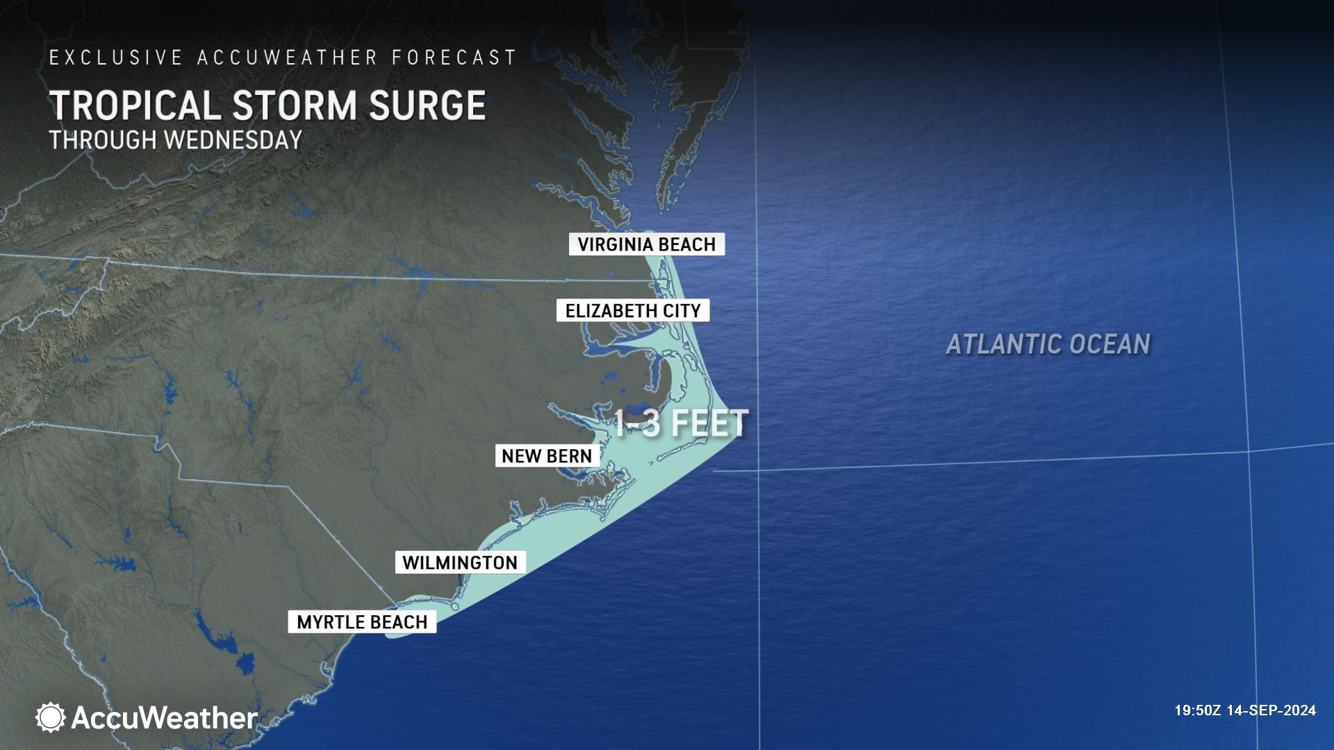
AccuWeather expert meteorologists say 1-3 feet of storm surge is forecast along the North Carolina coast. Storm surge impacts could reach as far north as Virginia Beach, Virginia, and as far south as Myrtle Beach, South Carolina.
“Coastal flooding could be significant with the long duration of the storm surge and water piling up after several high and low tide cycles. Portions of the southern Chesapeake and across the Outer Banks, both ocean and sound side, could see several cycles of flooding high tides,” Reppert warned. “The past few months have seen several houses succumb to beach erosion along the Outer Banks. There are homes in this area that sit precariously close to the water. Some of those oceanfront homes may be damaged or potentially swept away in this storm.”
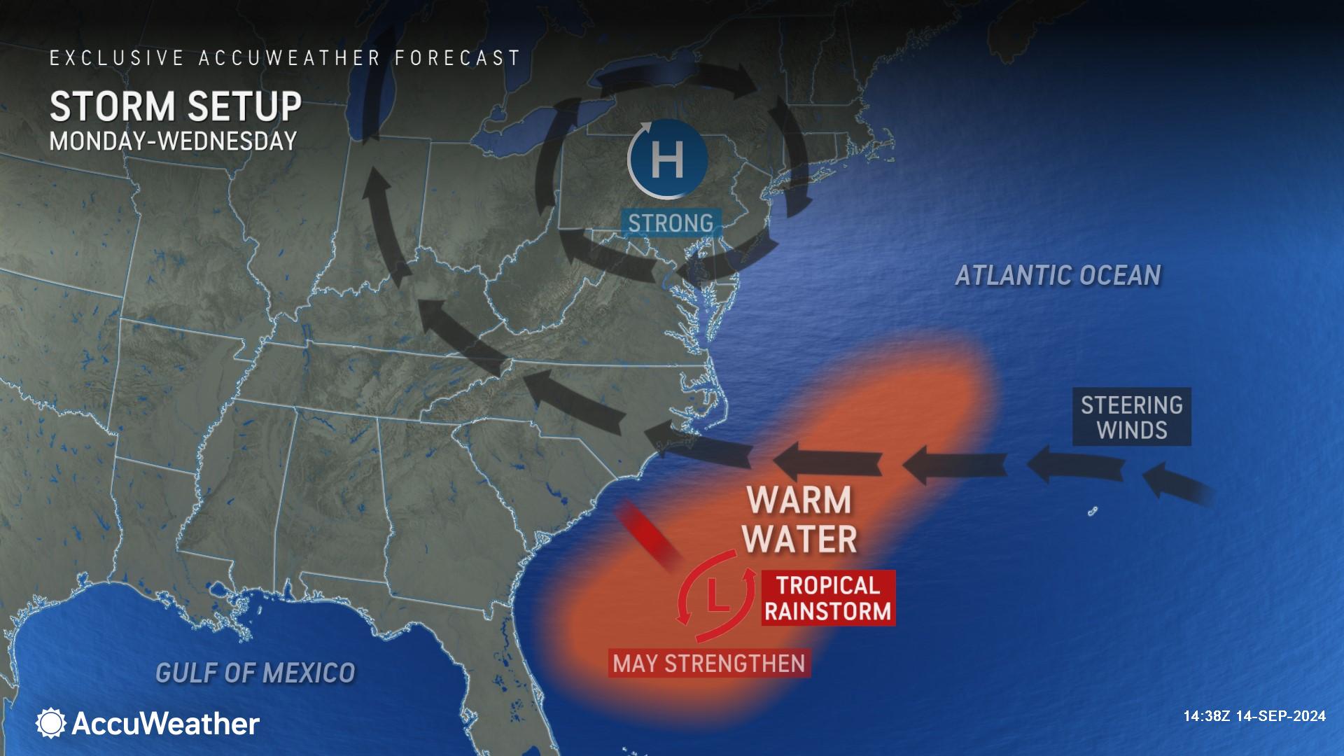
If this developing storm slows down and spends more time over the exceptionally warm ocean waters off the Southeast coast, AccuWeather expert meteorologists say it could potentially further strengthen and bring higher rainfall totals and stronger wind gusts to the Carolinas and mid-Atlantic.
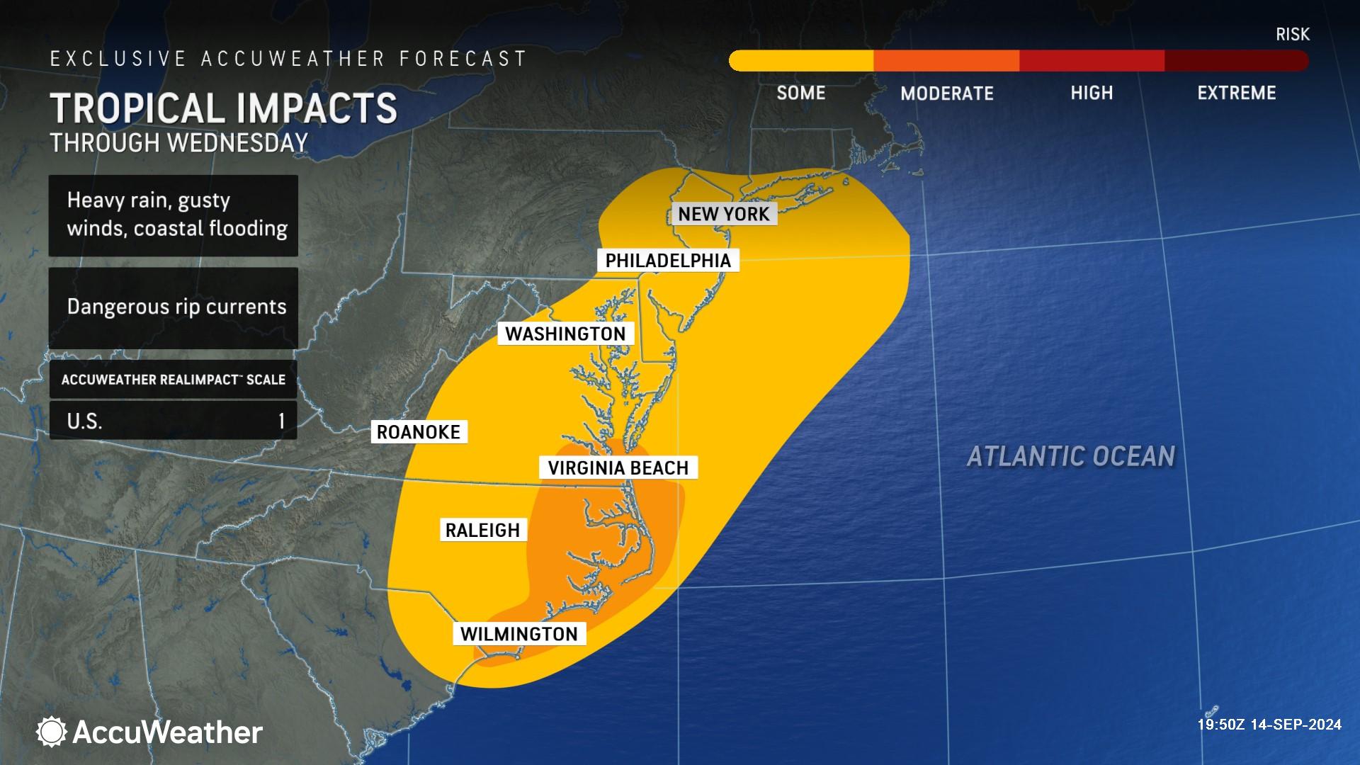
Due to impacts from flooding rainfall, gusty winds, isolated tornadoes and storm surge, this rainstorm is a 1 on the AccuWeather RealImpact™ Scale for Hurricanes in the United States, which warns of localized flooding, damage to unanchored mobile homes, tree damage, localized power outages and coastal inundation resulting in some property damage.
In contrast to the Saffir-Simpson Hurricane Wind Scale, which classifies storms by wind speed only, the AccuWeather RealImpact™ Scale is based on a broad range of important factors. In order to better communicate a more comprehensive representation of the potential impact of a storm on lives and livelihoods, the scale covers not only wind speed, but also flooding rain, storm surge and economic damage and loss. Some of these hazards, such as inland flooding and storm surge in many storms, result in more deaths and economic loss than wind.
AccuWeather expert meteorologists are urging families, businesses, emergency officials and government leaders to remain vigilant as tropical activity intensifies in September, as AccuWeather first warned back in August.
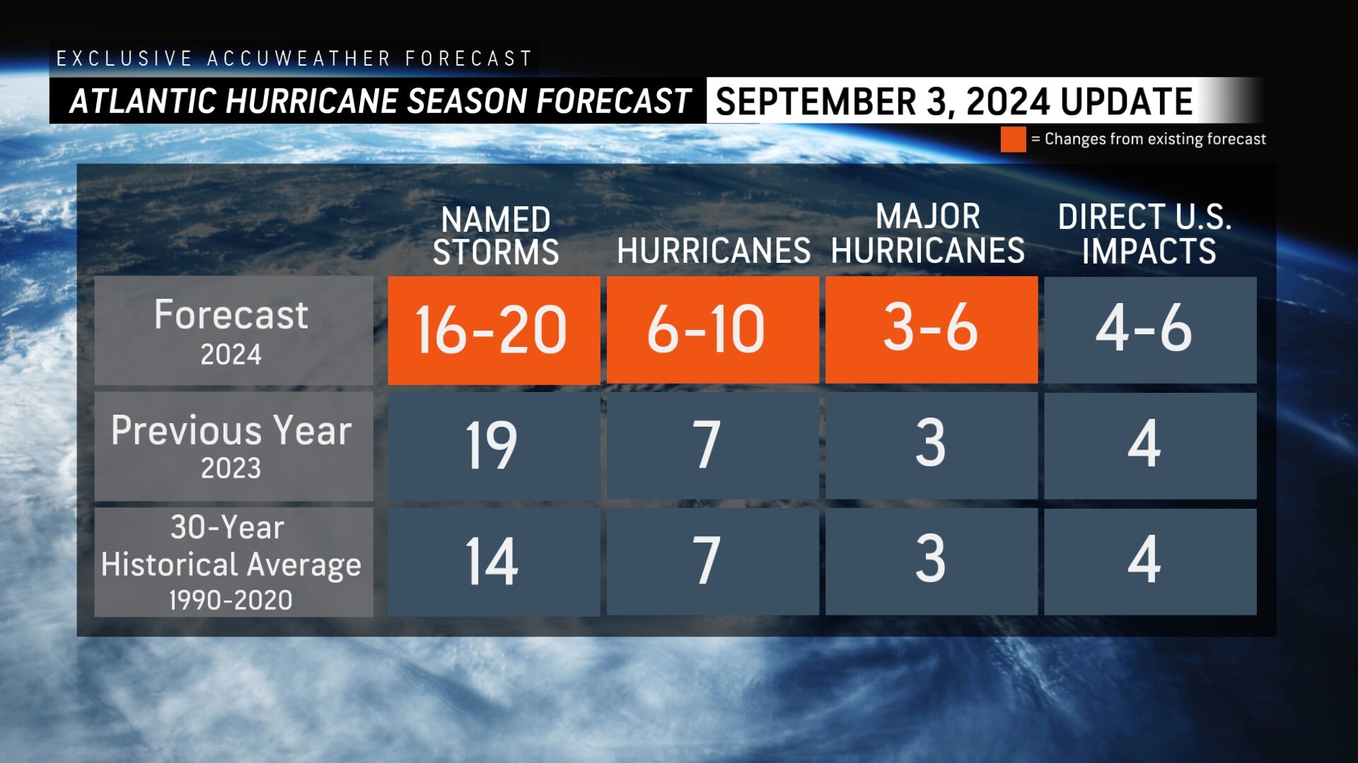
AccuWeather was the first known source to reduce the forecast for the number of named storms, hurricanes and major hurricanes expected during the 2024 Atlantic Hurricane season following the first Labor Day weekend without a named storm in decades.
AccuWeather Forecast Graphics
Additional AccuWeather Resources:
Tropical wind and rainstorm brewing near the Carolina coast to track inland
Southern US braces for more rain, flooding as Francine fades
Hurricane Tracking & Storm Radar
AccuWeather Forecasting 6 to 10 named storms during Supercharged September
AccuWeather Reduces Forecast for Number of Named Storms and Hurricanes During 2024 Atlantic Hurricane Season
Rapidly Intensifying Hurricanes Near Coastline Pose Major Threat To US This Season


