AccuWeather meteorologists are available 24/7 to provide further insights and updates on evolving weather conditions. Please contact pr@accuweather.com during regular business hours, or support@accuweather.com or call AccuWeather’s Media Hotline at (814)-235-8710 at any time to arrange interviews with AccuWeather experts or to request the most updated graphics for print or broadcast.
Elevated risk of flooding in the Southeast and mid-Atlantic
Sept. 13, 2024
Heavy rainfall from Tropical Rainstorm Francine, as well as impacts from a new storm forming off the coast of the Carolinas, will raise the risk of flash flooding across the Southeast this weekend before expanding into the mid-Atlantic next week.
AccuWeather Global Weather Center – Sept. 13, 2024
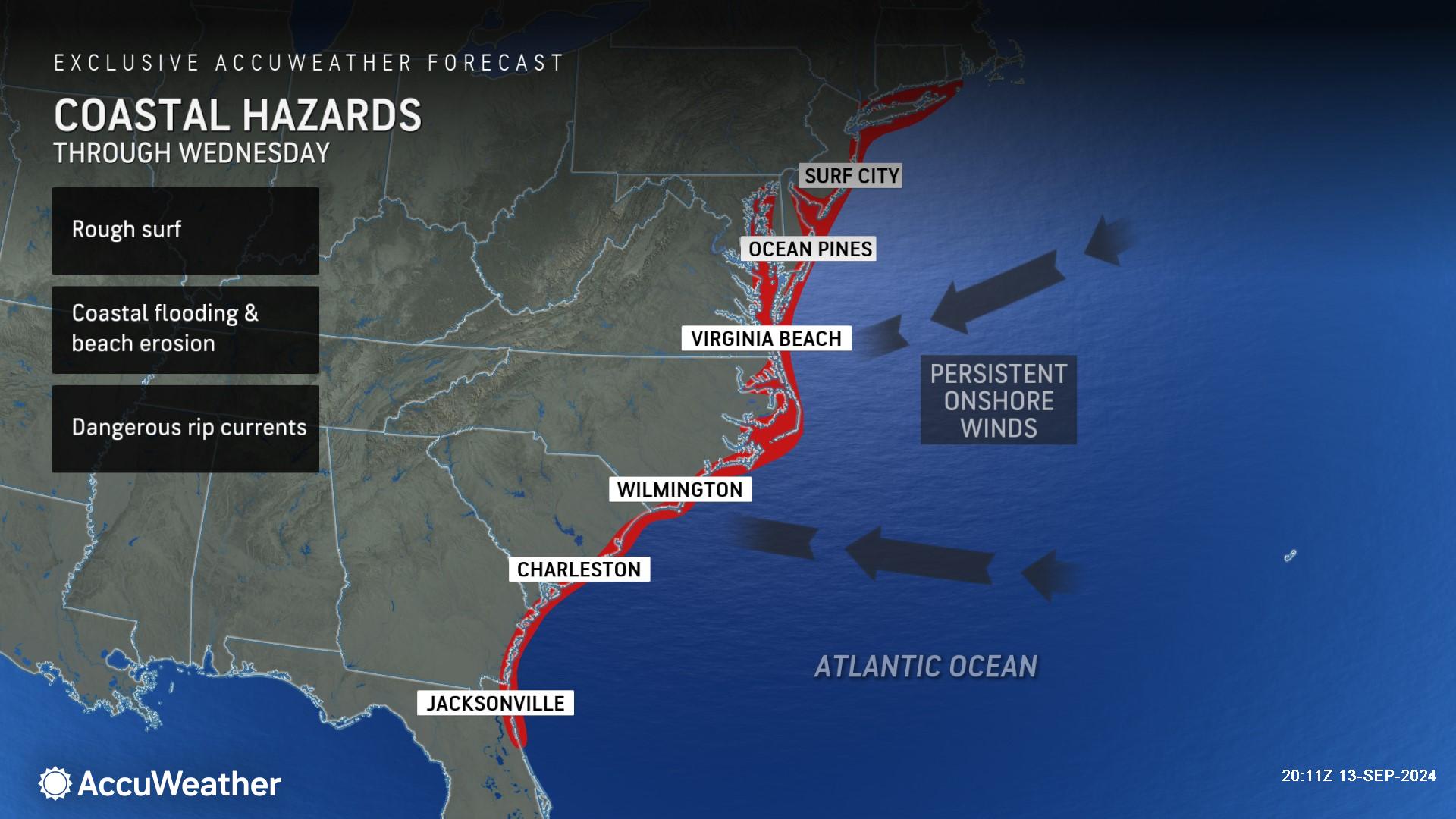
Much of the Virginia and Carolina coastline will be slammed with rough surf and beach erosion as a tropical rainstorm brews off the coast over the weekend.
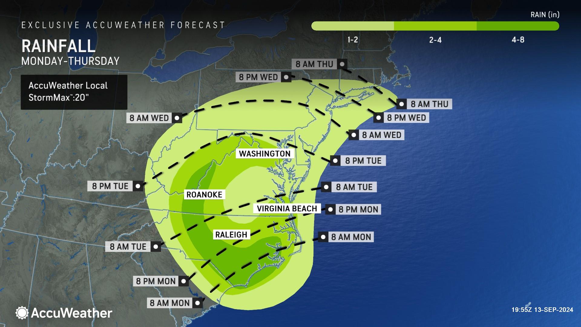
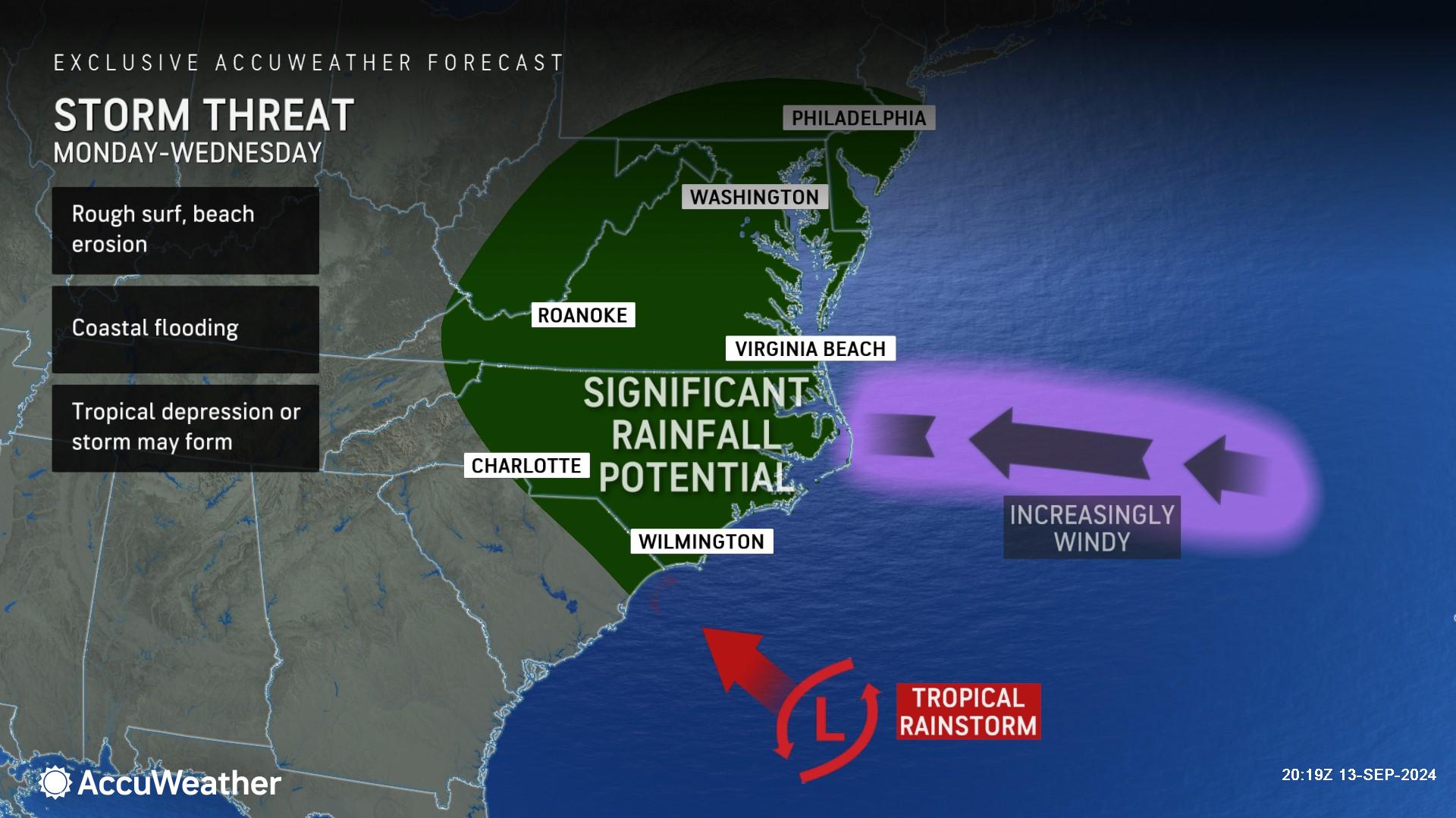
AccuWeather expert meteorologists say families and businesses across North Carolina, southern Virginia and northern parts of South Carolina need to be prepared for the risk of heavy rainfall, coastal flooding and flash flooding early next week.
“People along the coast of North Carolina need to be prepared for impacts from a tropical storm by Monday,” said AccuWeather Chief On-Air Meteorologist Bernie Rayno. “Even if this storm is not officially named, the impacts will feel the same.”
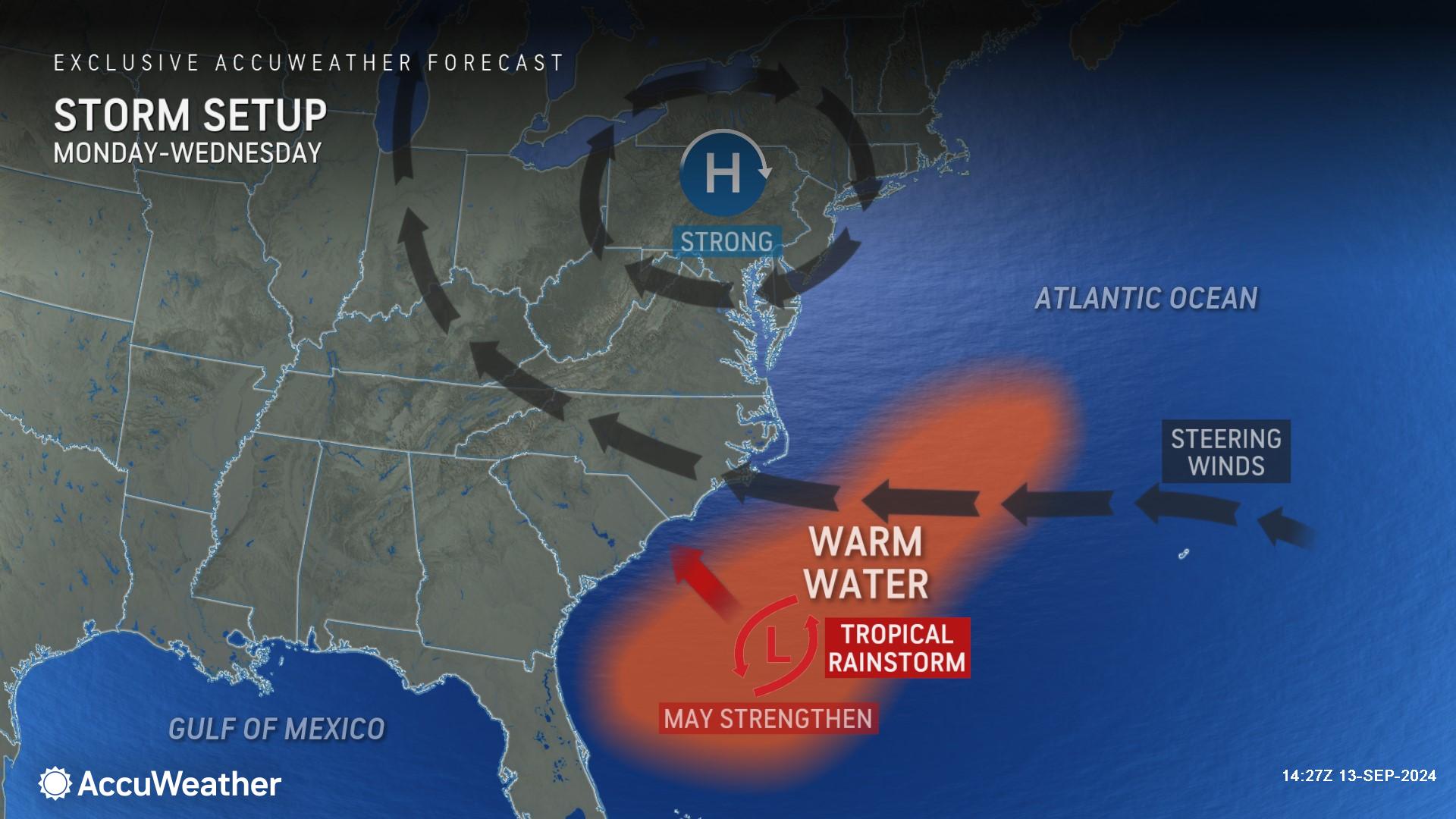
Rayno said this developing storm could potentially stall over land for several days. AccuWeather expert meteorologists began referring to the system as a tropical wind and rainstorm on Wednesday to help raise public awareness of conditions that could put lives and property at risk and to help officials plan and prepare.
“We call this type of setup ‘homegrown development.’ That’s when there’s interaction between the jet stream and the tropics close to the United States in the Gulf of Mexico, northwest Caribbean, or southwest Atlantic,” Rayno explained. “The longer a frontal boundary or upper-level low pressure area sits over the warm waters, the more likely it could develop into a tropical storm. This setup typically happens during June, July and August, but this has been an unusual weather pattern and hurricane season.”
AccuWeather expert meteorologists say this evolving storm with persistent onshore winds will increase the risk of rough surf, dangerous rip currents, beach erosion and coastal flooding from the Delaware coast, along the Carolinas and Georgia coast, reaching as far south as Jacksonville, Florida, through Wednesday.
For a tropical depression to be declared, the system must be tropical in nature, have a defined circulation and sustained winds less than 39 miles per hour. The same conditions with winds of 39-73 mph designate a tropical storm.
Flooding concerns in the Southeast
As Francine's circulation slowly fades over the south-central United States, AccuWeather expert meteorologists say risks to lives and property will continue into the weekend due to the risk of flash flooding.
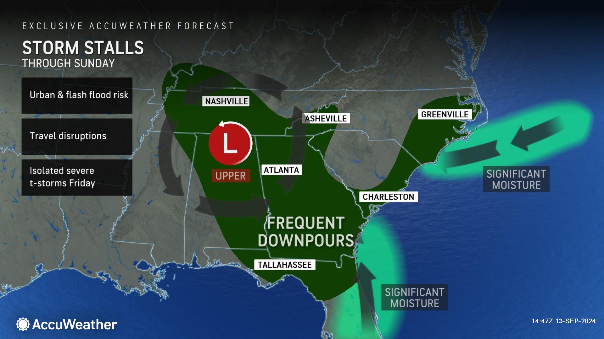
Because Francine has stalled due to high pressure and a sea of dry air to the north, steering breezes of its leftover moisture will tend to get strung out in a narrow zone for many hundreds of miles in a northwest-to-south fashion that extends from the mid-Mississippi Valley to near the southern Atlantic coast.
AccuWeather Meteorologist Brandon Buckingham said there is a risk of heavy rainfall and flooding in parts of Alabama, Georgia, Florida, Mississippi and Tennessee this weekend.
"A prolonged period of moisture funneling in from both the Gulf of Mexico and the Atlantic Ocean will result in areas of heavy rain with a heightened flood threat across portions of the Southeast through the weekend and into next week," said Buckingham.
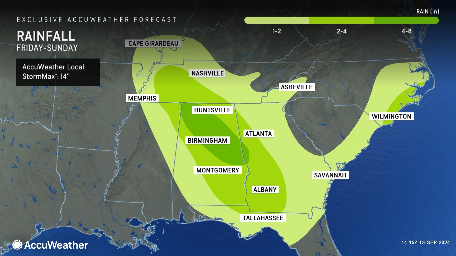
An additional 1-4 inches of rain will pour down in an area stretching from the confluence of the Mississippi and Ohio rivers to Georgia and northern Florida, with a zone where 4-8 inches will fall from near southern Tennessee through portions of northern and central Alabama to near northwestern Georgia. The AccuWeather Local StormMax™ is 14 inches of rainfall.
“Intense rainfall rates of 2 inches per hour or more could cause significant flash flooding,” said AccuWeather Chief Meteorologist Jon Porter. “Please use caution traveling through the Southeast this weekend and never try to drive down a flooded street.”
AccuWeather expert meteorologists say there is a potential of extreme flash localized flooding in low-lying and urban areas, as well as along small streams. Significant rises on secondary rivers could also occur.
Eye on the tropics next week
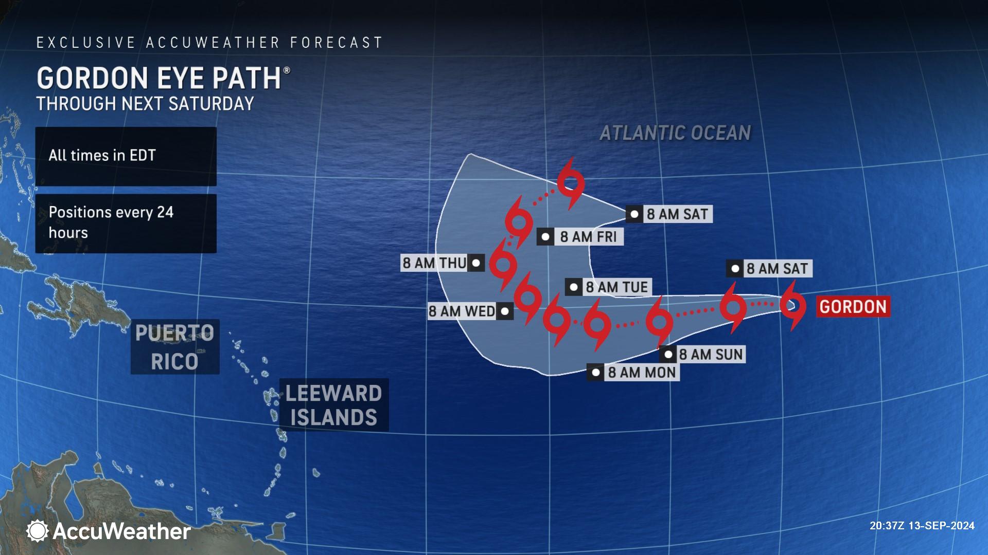
AccuWeather expert meteorologists say Tropical Storm Gordon is forecast to move westward through the open Atlantic with no threat to land for at least the next week.
Following Gordon, the next name on the list of tropical storms for the 2024 Atlantic hurricane season is Helene.
By the end of next week, Rayno says there is also the potential of additional tropical trouble percolating closer to the United States.
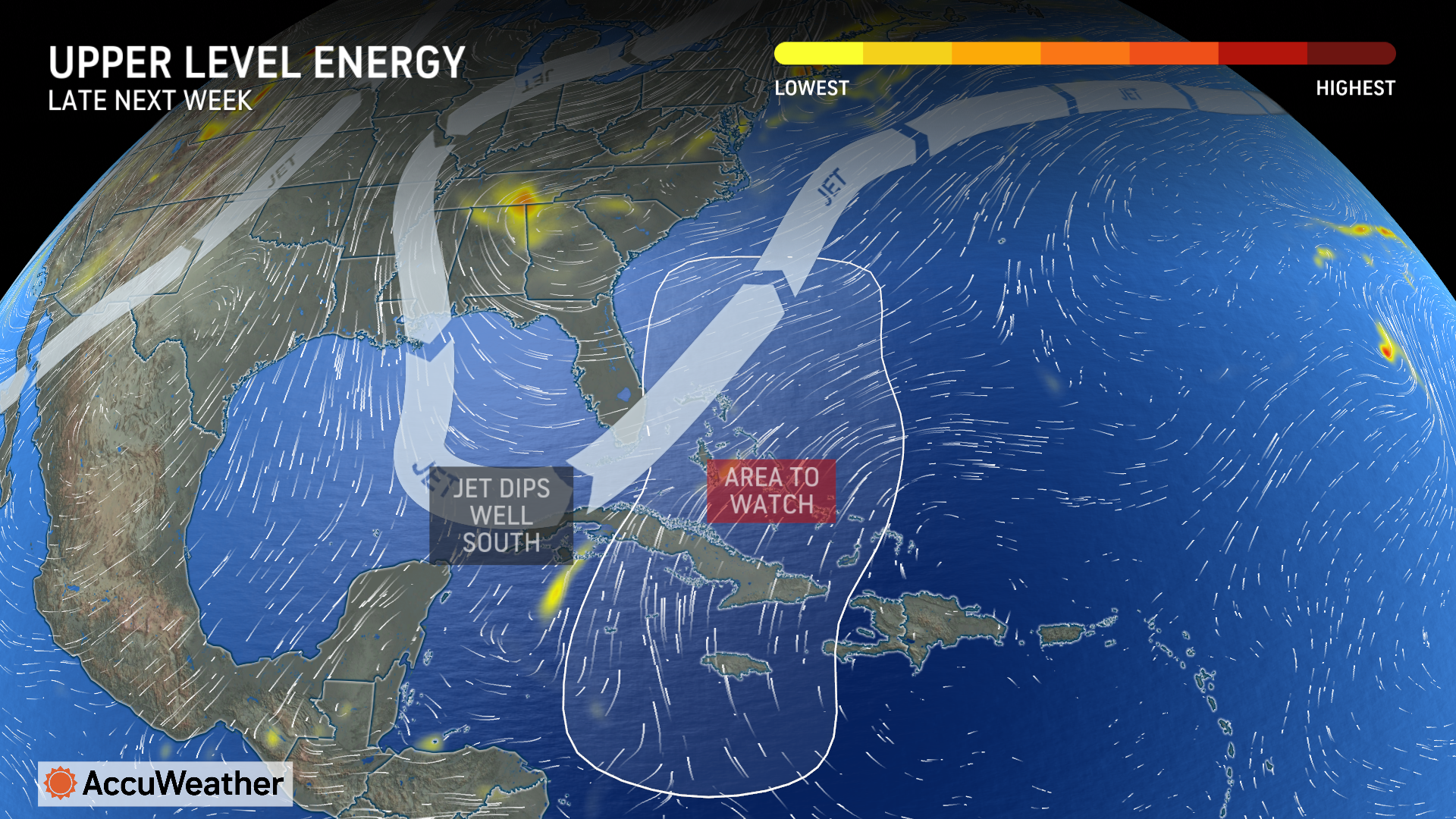
“We’re sounding the alarm for potential tropical trouble late next week. A big dip in the jet stream could trigger more development in the Central Caribbean or the southwest Atlantic off the coast of Florida,” said Rayno.
AccuWeather expert meteorologists are urging families, businesses, emergency officials and government leaders to remain vigilant as tropical activity intensifies in September, as AccuWeather first warned back in August.
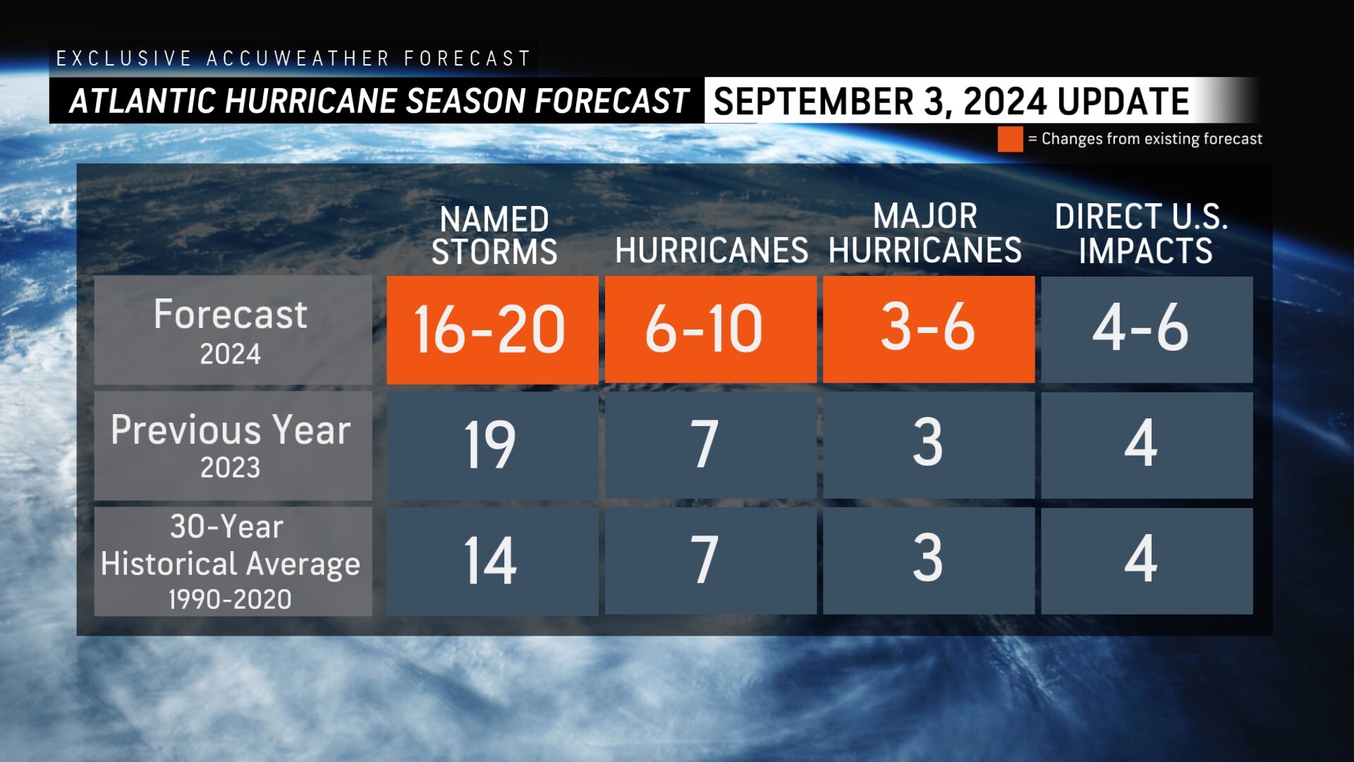
AccuWeather was the first known source to reduce the forecast for the number of named storms, hurricanes and major hurricanes expected during the 2024 Atlantic Hurricane season following the first Labor Day weekend without a named storm in decades.
AccuWeather Forecast Graphics
Additional AccuWeather Resources:
Hurricane Tracking & Storm Radar
Tropical trouble brewing near the Carolina coast; may track into US
Southern US braces for more rain, flooding as Francine fades
AccuWeather Forecasting 6 to 10 named storms during Supercharged September
AccuWeather Reduces Forecast for Number of Named Storms and Hurricanes During 2024 Atlantic Hurricane Season
Rapidly Intensifying Hurricanes Near Coastline Pose Major Threat To US This Season


