AccuWeather meteorologists are available 24/7 to provide further insights and updates on evolving weather conditions. Please contact pr@accuweather.com during regular business hours, or support@accuweather.com or call AccuWeather’s Media Hotline at (814)-235-8710 at any time to arrange interviews with AccuWeather experts or to request the most updated graphics for print or broadcast.
Atmospheric river to slam the Northwest; storms and snow could impact parts of the Northeast and Great Lakes this week
Nov. 18, 2024
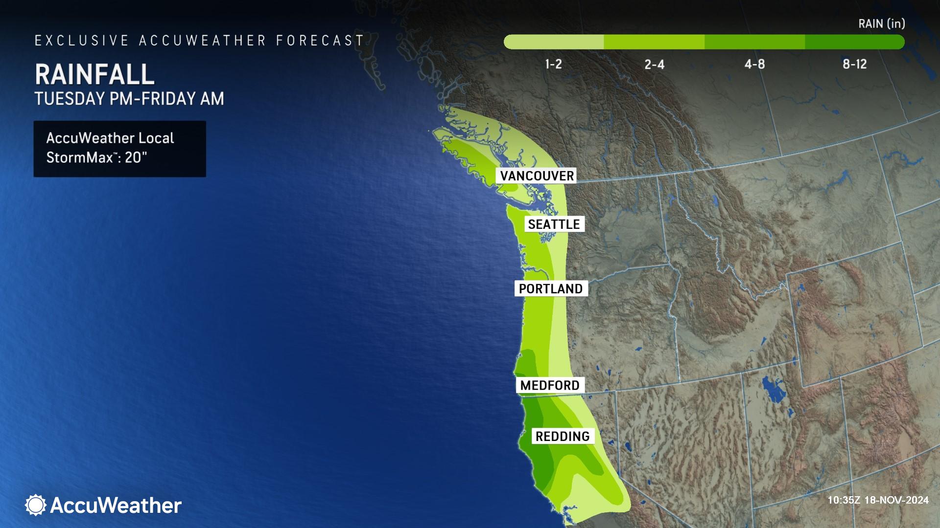
> Two storms could unleash mountain snow and 8-12 inches of rainfall in parts of Oregon and California with an AccuWeather Local StormMax™ of 20 inches
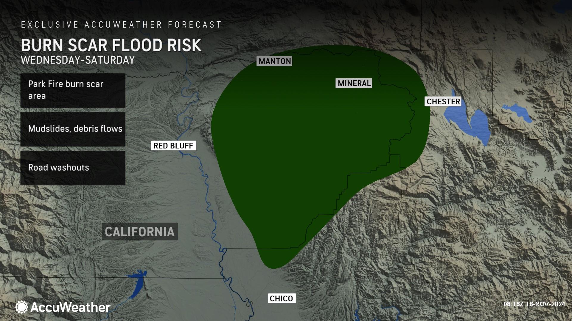
> Increasing risk of flooding, mudslides and debris flows in the Park Fire burn scar area in northern California later this week
> A strengthening storm could produce heavy downpours and snow in parts of the Midwest, Northeast and Great Lakes region
> Rainfall and gusty winds from Tropical Rainstorm Sara are expected to reach parts of the U.S. Gulf Coast later this week
AccuWeather Global Weather Center – Nov. 18, 2024
AccuWeather expert meteorologists are forecasting a stormy pattern to impact millions of people across America this week with the threat of flooding, travel disruptions and the potential for the first accumulating snowfall of the season in some places.
First Atmospheric River of the season
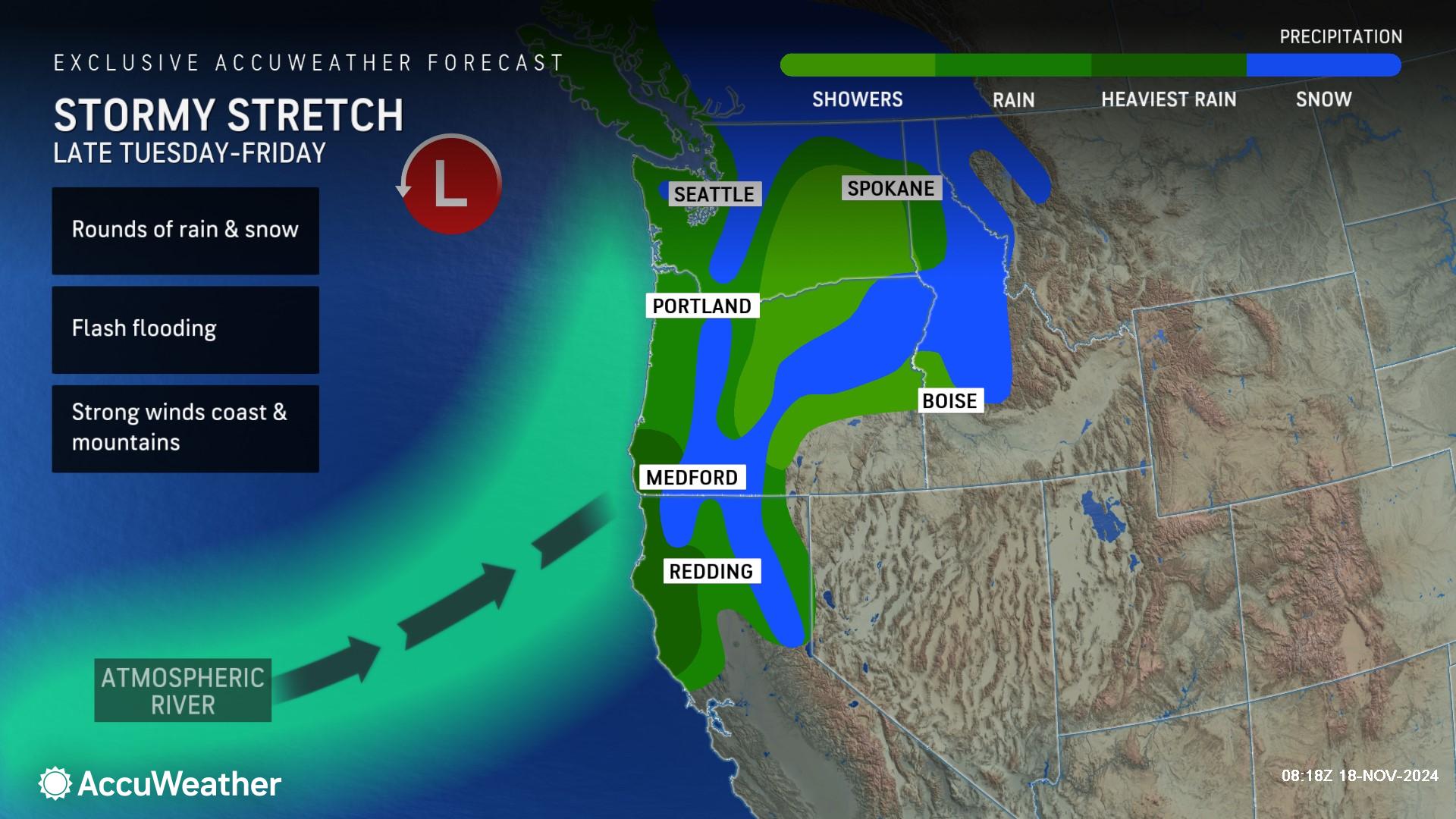
Flooding rainfall and mountain snow are expected along parts of the West coast this week, with the worst of the impacts expected to occur across Northern California.
“It’s a stormy week in Northwest. We have a huge storm on the way with soaking rain and mountain snow. A foot or more of rain is possible in some spots by the end of this week,” said AccuWeather Chief On-Air Meteorologist Bernie Rayno.
AccuWeather expert meteorologists are closely monitoring the potential for major flooding, powerful wind gusts and feet of snow in the mountains later this week, which will pose a risk to lives and property across the region. Between Tuesday afternoon and Friday, the potential exists for 8-12 inches of rainfall in Northern California with an AccuWeather Local StormMax™ of 20 inches of rain possible.
Conditions are expected to deteriorate along the Interstate 5 corridor from Northern California into western Oregon and Washington on Tuesday before a narrow plume of moisture is expected to focus the risk for major flooding across Northern California on Wednesday, which can then continue to train over the same areas repeatedly through Friday.
The plume of heavy rain is expected to heighten the risk for mudslides, debris flows and road closures in many burn scar areas across the region later this week. AccuWeather expert meteorologists say there is an elevated risk of life-threatening impacts in the Park Fire burn scar area, as the charred ground will be rendered ineffective at absorbing the falling rain. More than 400,000 acres in Northern California were scorched by the Park Fire this summer.
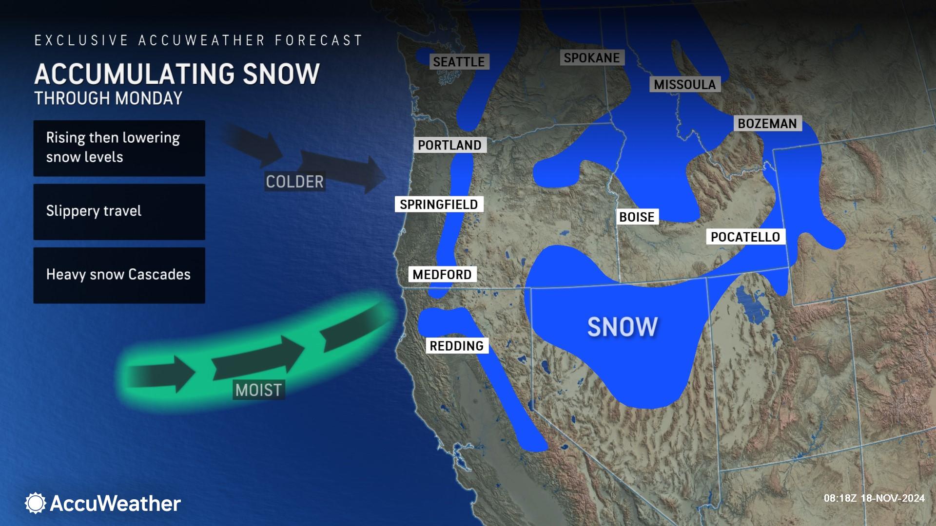
Heavy snow is expected to span across the Cascades, northern Rockies and northern Sierra Nevada Range, posing a risk to travelers attempting to make it through mountain pass roads. Road closures are possible this week as a result of this storm, which can impact travel and logistic operations in the area.
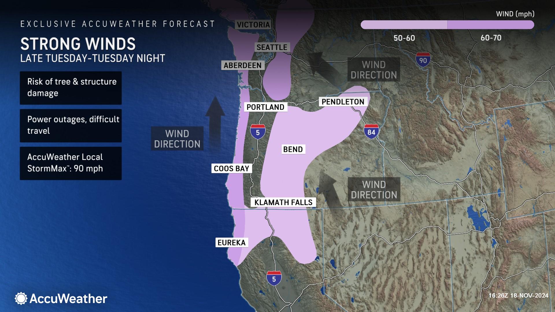
AccuWeather expert meteorologists say wind gusts of 50-60 miles per hour are possible in the mountains and gusts of 60-70 mph are possible along the Pacific Coast Tuesday with an AccuWeather Local StormMax™ of 90 mph.
Major storm expected in the Northeast
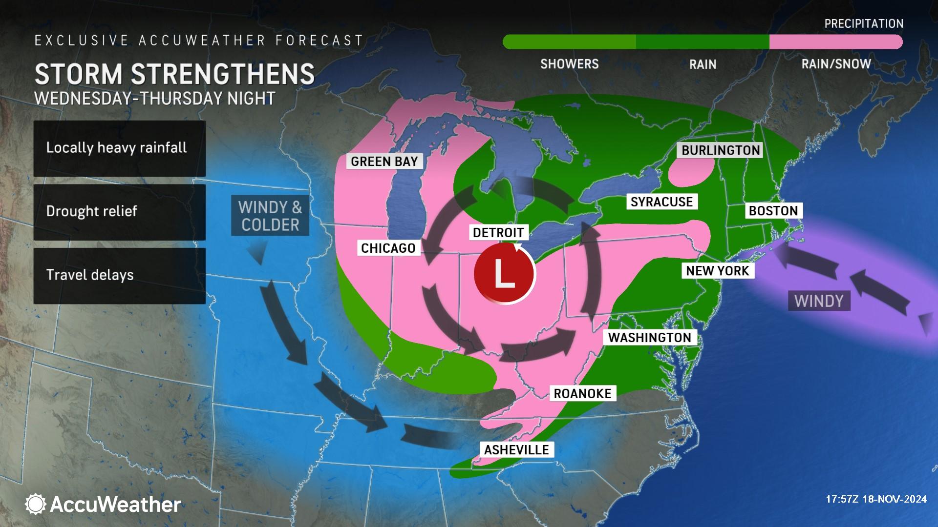
Some people may see their first accumulating snowfall of the season from a major storm brewing expected over the Great Lakes this week.
Rayno said the storm will also produce gusty winds and much-needed rain in some areas that are dealing with fires or drought.
“This beneficial rain will help with the smoldering brush fires and drought conditions across the northeast,” said Rayno. “The storm will then move across Ohio and Pennsylvania. Get ready, we could see accumulating snow in places like the Laurel Highlands of Pennsylvania and along the spine of the Appalachians, all the way down the mountains of North Carolina.”
The winds will ramp up on Wednesday and peak during Thursday and Friday but may persist in some areas through the weekend. Waves may get very rough on the Great Lakes, and strong winds may lead to renewed power outages where trees are still damaged in the southern Appalachians in the wake of Helene from late September.
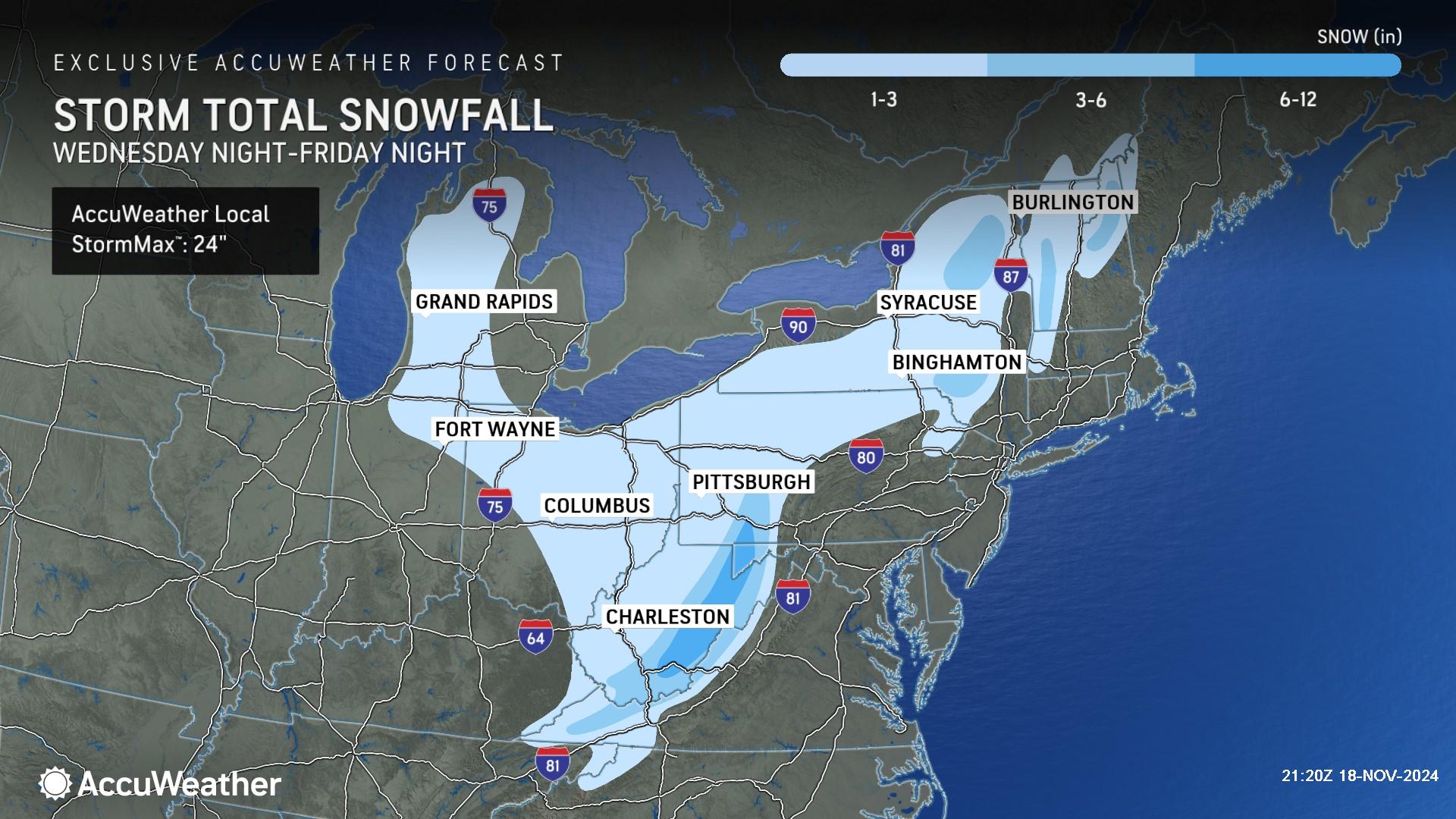
Snow will go along with the cold air, and as the cold air passes over the warm waters of the Great Lakes, lake-effect snow will develop and can become locally heavy. Snow is also likely to develop farther south with the colder air over parts of the Ohio Valley and the central and southern Appalachians beginning Wednesday night and lasting in some areas into the weekend.
AccuWeather expert meteorologists are forecasting a zone of 3-6 inches of snow in the higher elevations of southwestern Pennsylvania and parts of Maryland and West Virginia, with an AccuWeather Local StormMax™ of 24 inches.
The storm and a cold front associated with it could bring showers and perhaps a thunderstorm to some Eastern states. AccuWeather expert meteorologists say this storm may not bring enough rain to substantially improve the drought situation.
Drought conditions will continue to worsen in the Northeast with 96% of the region now either abnormally dry or experiencing drought.
Downpours and gusty winds from Tropical Rainstorm Sara
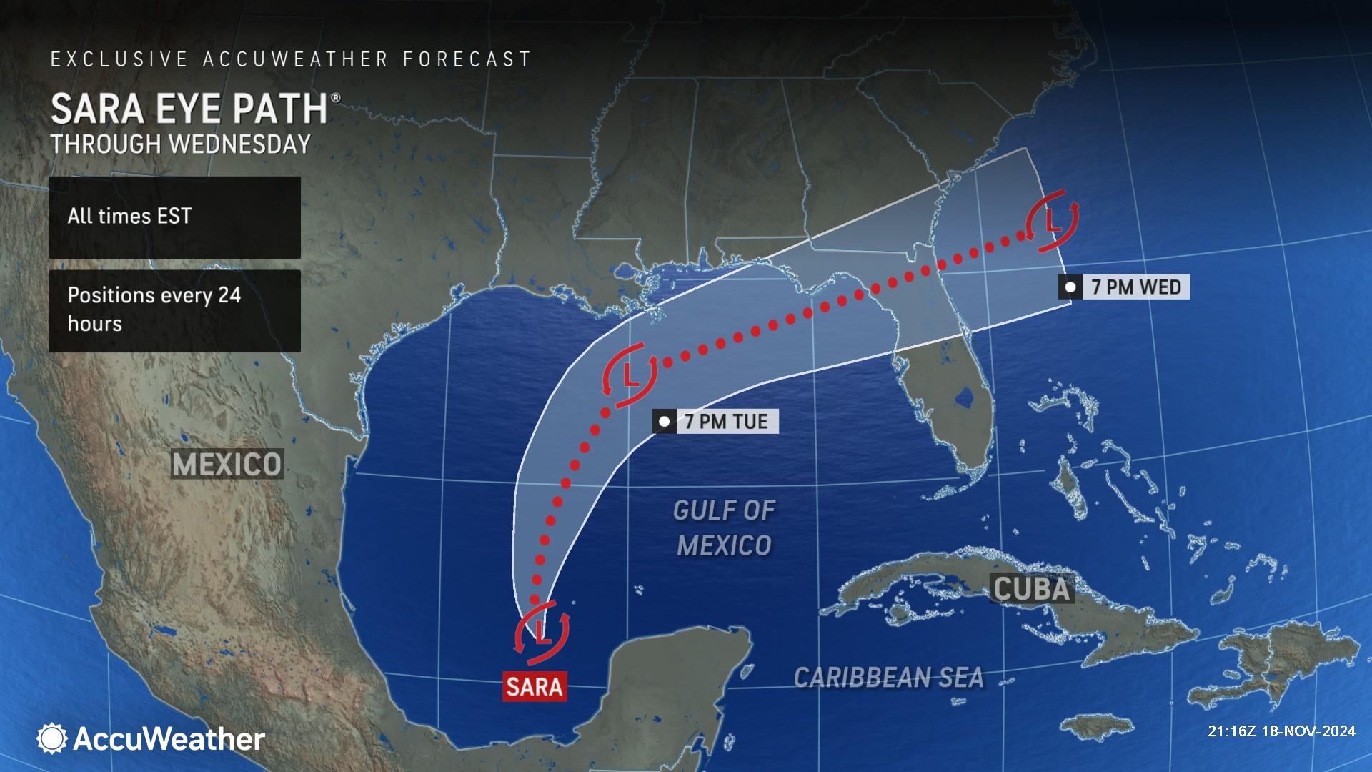
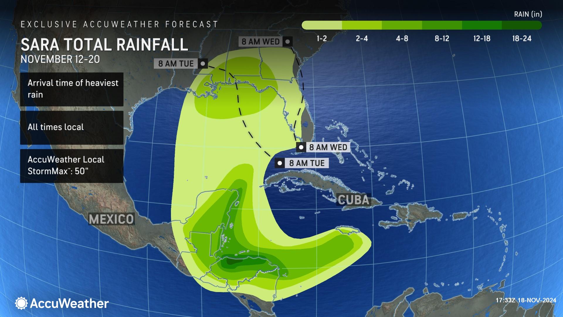
After unleashing catastrophic rainfall that triggered life-threatening flooding in Central America, AccuWeather hurricane experts say Tropical Rainstorm Sara will bring downpours to parts of the United States Gulf Coast this week.
As Sara tracks northward through Monday night, a cold front will advance eastward through Arkansas and Louisiana. This front will draw some of Sara's moisture northward. Even though Sara will largely be stretched out and start to lose its identity by Monday night and Tuesday, its moisture will enhance rainfall along the Gulf Coast.
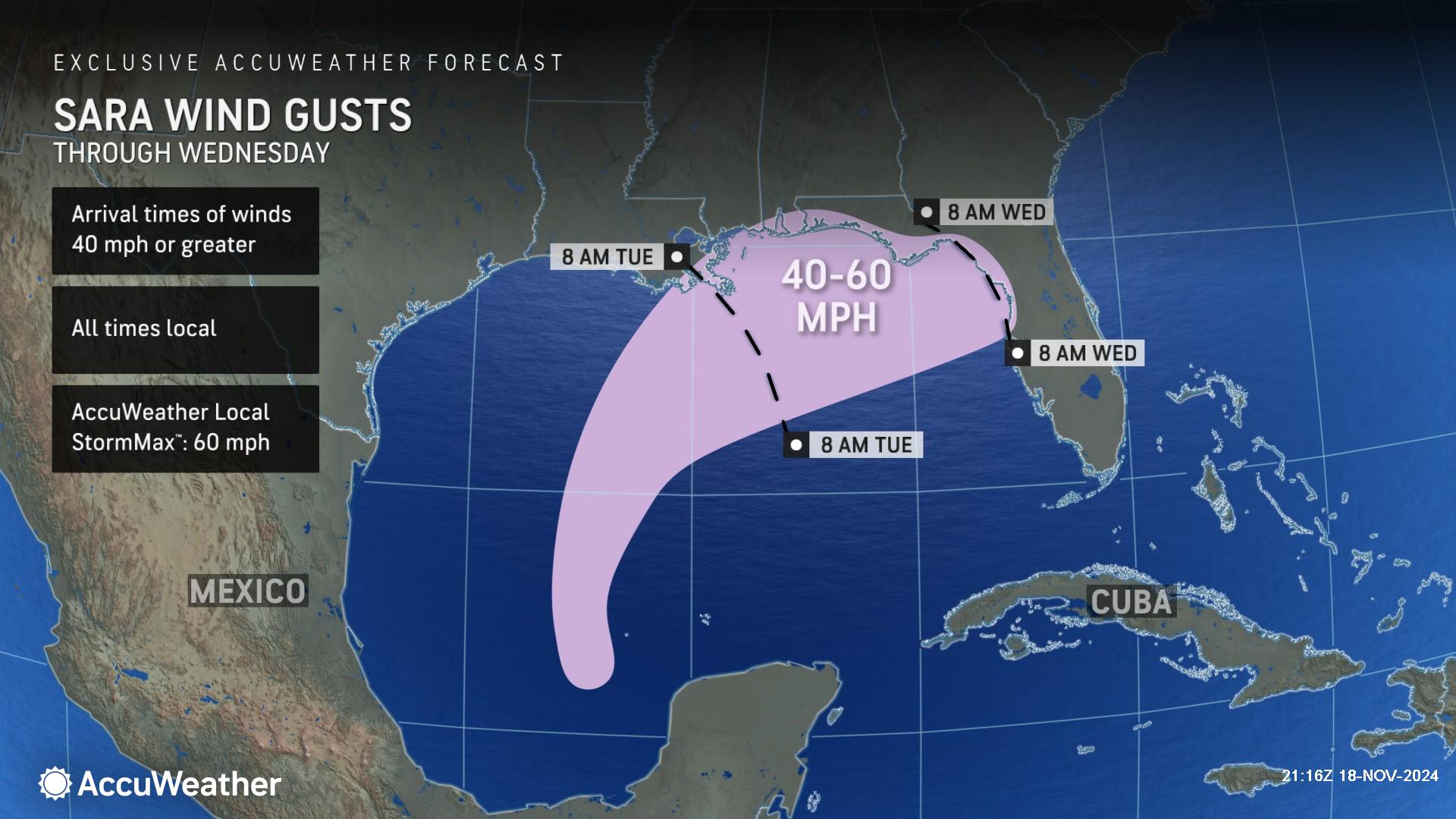
"Tropical Rainstorm Sara can bring flooding downpours to the northern Gulf Coast Monday night through Tuesday night, with a wide swath of 2-4 inches from eastern Louisiana to the Florida Panhandle," said AccuWeather Lead Hurricane Expert Alex DaSilva. "Winds can occasionally gust to 40-60 mph, with the highest wind gusts likely to be confined to the coast and coinciding with any heavier downpours.”
DaSilva also pointed out that the spin associated with Sara could produce a few isolated tornadoes. There is a risk of rough surf and dangerous rip currents along the Gulf Coast through Wednesday.
Additional tropical storms or subtropical storms may be possible in the open Atlantic in late November and even early December, but DaSilva said any additional tropical impacts in the U.S. after Sara are highly unlikely.
“We expect Sara to be the last round of tropical impacts in the U.S. this year,” said DaSilva.
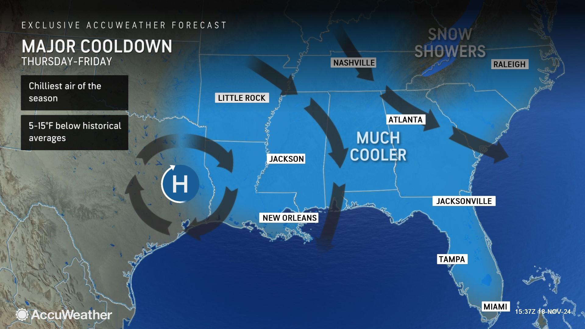
AccuWeather expert meteorologists say the chilliest air of the season will arrive across much of the Southeast and Florida later this week. Temperatures could drop 5-15 degrees below the historical average in some places on Thursday and Friday.
AccuWeather Forecast Graphics
Additional AccuWeather Resources:
More storms with rain, mountain snow lining up for northwestern US
Storm with wind, snow and some rain brewing for Midwest, East
Sara moves into Gulf, set to bring heavy rain to South, Southeast
AccuWeather Hurricane Tracker


