AccuWeather meteorologists are available 24/7 to provide further insights and updates on evolving weather conditions. Please contact pr@accuweather.com during regular business hours, or support@accuweather.com or call AccuWeather’s Media Hotline at (814)-235-8710 at any time to arrange interviews with AccuWeather experts or to request the most updated graphics for print or broadcast.
Severe thunderstorm and flooding risk on Election Day in central US
Nov. 1, 2024
> Voters and poll workers should prepare for wet and stormy weather across parts of the Gulf Coast through the Ohio Valley
> Warm and dry conditions are forecast along much of the East coast for Election Day
> AccuWeather Founder and Executive Chairman Dr. Joel Myers highlights the ways that weather has impacted politics and elections throughout American history in his debut book "Invisible Iceberg: When Climate and Weather Shaped History"
> A new tropical storm is expected to form in the Caribbean Sea in the next few days
AccuWeather Global Weather Center – Nov. 1, 2024
AccuWeather expert meteorologists say a multi-day severe weather threat starting this weekend will impact Election Day with the risk of severe thunderstorms from eastern Texas and Louisiana through southern Illinois and Indiana to western Ohio, and southern Michigan.
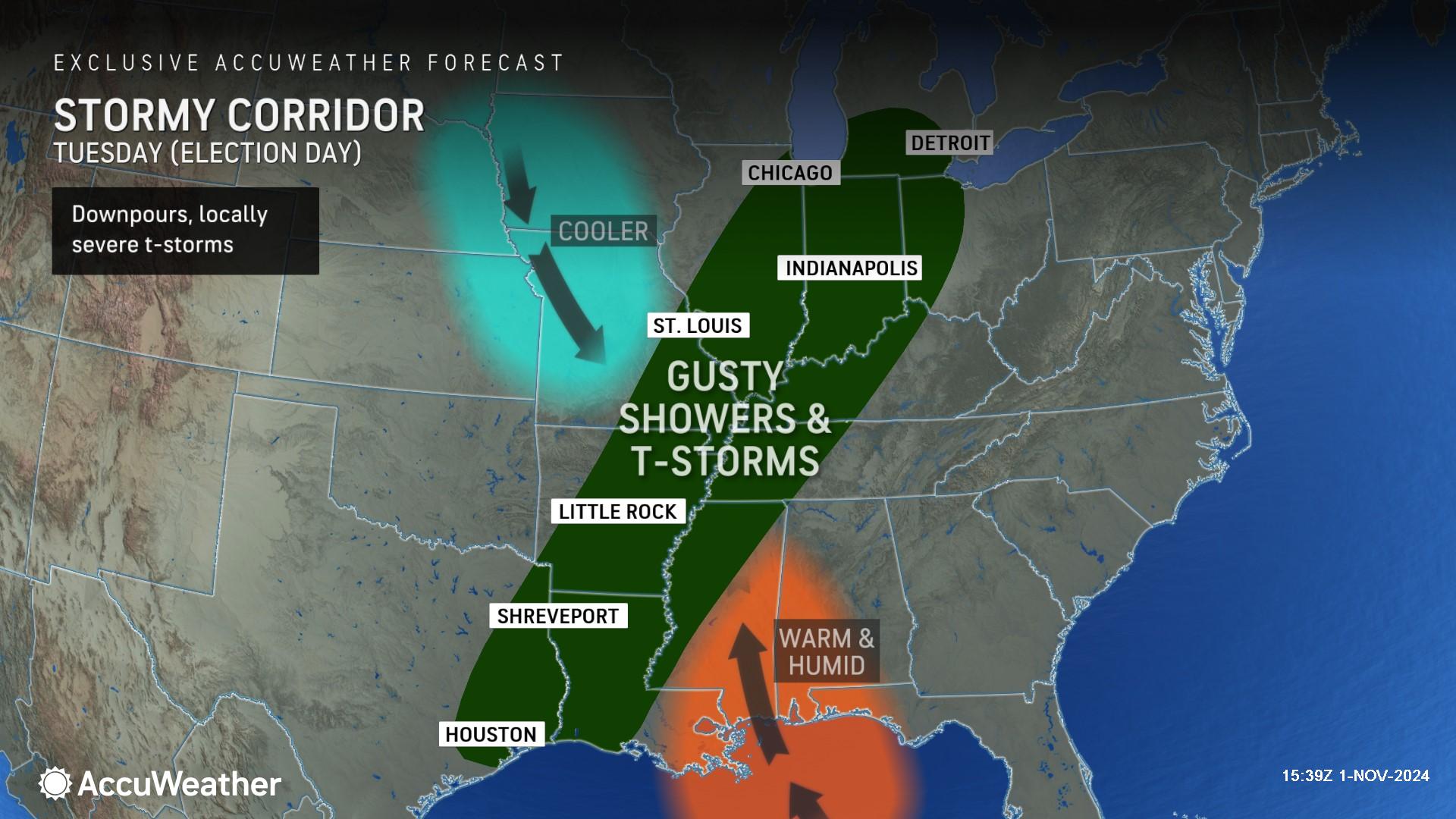
AccuWeather Senior Director of Forecasting Operations Dan DePodwin says there will still be a strong west-to-east temperature contrast zone with plenty of moisture in the warm air on Election Day, creating conditions for heavy, gusty and locally severe thunderstorms.
“Voters and poll workers should be prepared for stormy weather on Election Day in these areas. We expect some gusty thunderstorms along parts of the Gulf coast and Mississippi Valley, all the way up to the Ohio Valley,” DePodwin said. “Check the forecast on the AccuWeather app before you head to the polls on Tuesday. You do not want to be caught off guard, waiting outside in line if a thunderstorm moves in.”
Torrential downpours, localized flash flooding and the risk of lightning strikes can cause trouble for workers and voters waiting in long lines at the polls, as well as travel delays.
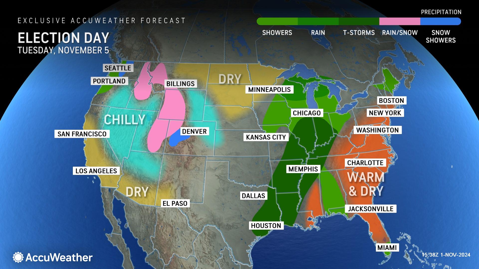
AccuWeather expert meteorologists are forecasting warm and dry conditions on Election Day across much of the East Coast and Southeast, the potential for rain and snow in parts of the Rockies and chilly conditions across parts of the West and Southwest.
Stormy weekend on tap
A new storm is poised to deliver multiple days of severe weather from the Plains this weekend to the Mississippi Valley early next week.
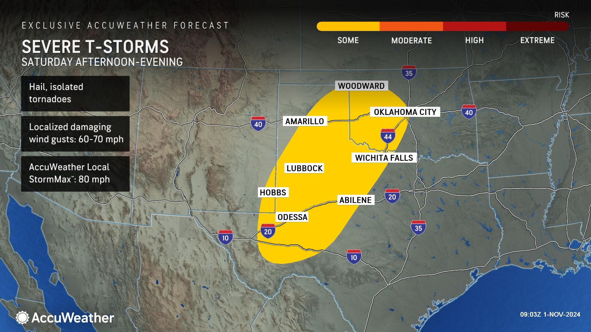
Thunderstorms over the southern Plains will be slightly boosted beginning on Saturday as a storm swings northward from Mexico ahead of a storm pushing inland over the Northwest. The highest risk of severe thunderstorms packing hail, strong wind gusts and isolated tornadoes on Saturday will extend from West Texas and along the eastern border of New Mexico northeastward to western and central Oklahoma.
AccuWeather expert meteorologists say the two storms will combine forces as the weekend progresses. Additionally, an influx of moisture from the Gulf of Mexico, a resurgence of warmth, and jet stream energy will crank up the intensity of the thunderstorms.
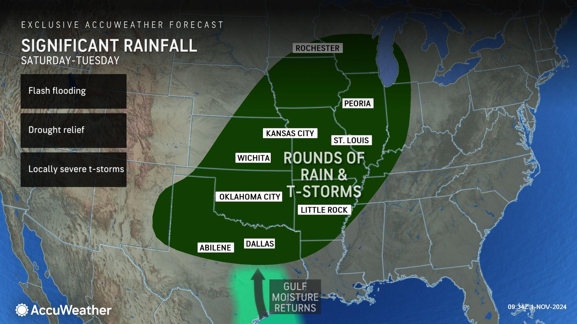
Meanwhile, the slow-moving nature of the storm system bringing the torrential downpours will push rainfall amounts to heavy and even excessive levels, leading to a flash flood risk.
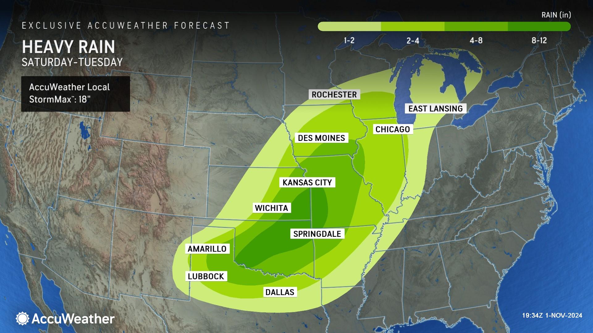
A broad area is forecast to receive 4-8 inches of rain from this weekend to next week. A pocket of 8-12 inches of rainfall is foreseen in parts of Oklahoma, Kansas and Missouri. Within this zone, there is an AccuWeather Local StormMax™ of 18 inches, which would more than wipe out the deficit of rainfall since the start of the summer.
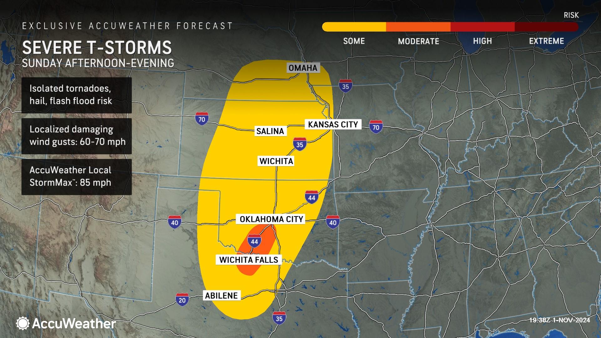
The risk of severe weather on Sunday will extend from west-central Texas northward to southeastern Nebraska and southwestern Iowa. The threat includes the major metro areas of Oklahoma City, Kansas City, Missouri, and Omaha, Nebraska, with high winds, hail, flash flooding and a few tornadoes.
Severe weather threat on the move next week
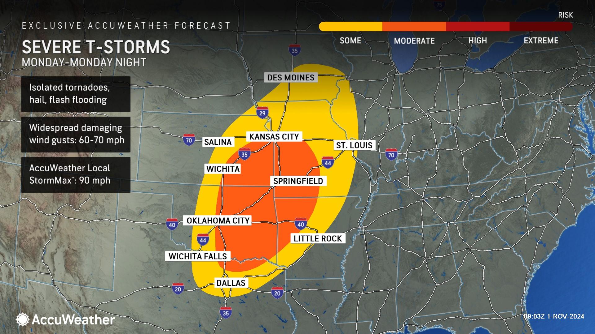
The severe weather threat will continue over roughly the same geographic region but will expand and shift farther to the east on Monday.
Severe weather on Monday will extend from north-central and northeastern Texas to central and eastern Iowa and western Illinois. Oklahoma City and Kansas City will be in the severe weather risk area on Monday, along with Dallas, St. Louis, Little Rock, Arkansas, and Des Moines, Iowa. AccuWeather expert meteorologists say people in the region should prepare for the threat of high winds, hail, flash flooding and tornadoes.
“The second severe weather season has returned in full force to the center of the country. You may want to take down your Halloween decorations and inflatables before these storms arrive,” said AccuWeather Senior Director of Forecasting Operations Dan DePodwin. “Severe thunderstorms and gusty winds can blow over political signs and banners. Make sure everything on your front yard, decks and balconies are secure so they don’t blow away.”
Tropical trouble brewing
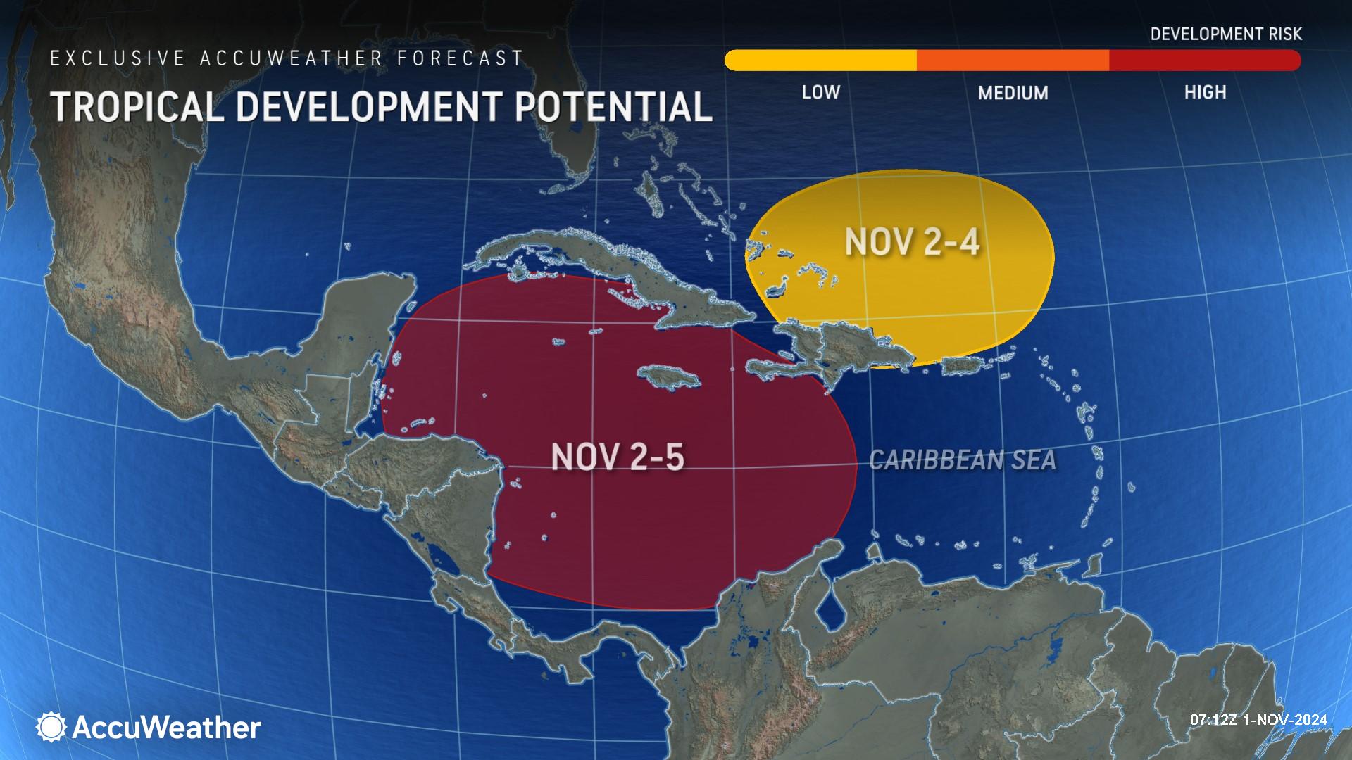
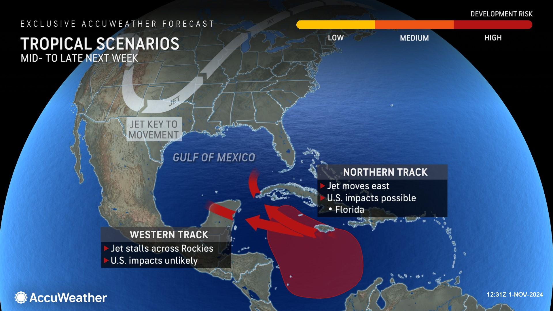
AccuWeather hurricane experts expect a tropical storm to form in the Caribbean in the next few days, which could then evolve into a hurricane before possibly bringing impacts to the United States.
The Caribbean Sea has been an area AccuWeather meteorologists have been watching since Oct. 21 for the next tropical storm in the Atlantic basin for the end of October or early November. Indications continue to point toward the likelihood of a named storm developing within the next five days and potentially threatening the United States Gulf Coast late next week to the second weekend of November.
"The track will depend on where it forms, but also the movement of a dip in the jet stream more than 1,000 miles away over the U.S. next week," said AccuWeather Chief On-Air Meteorologist Bernie Rayno. "If that jet stream dip pushes far enough to the east, it will tend to scoop up the tropical feature and possibly draw it across the southeastern Gulf of Mexico and into South Florida. If the jet stream dip lags to the west, the tropical feature may push westward across the Yucatan which may then allow it to get into the western or central Gulf of Mexico, where it could threaten areas as far to the west at Louisiana or Texas. There's also the possibility it continues due westward and diminishes over southern Mexico or Central America."
Tropical storms and hurricanes originating in the Caribbean this time of the year have previously experienced a highly curved or boomerang track. Hurricane Mitch from 1998 and Tropical Storm Keith from 1988 are examples.
"There has never been a tropical storm or hurricane landfall in Texas, Louisiana or Mississippi during November and December," said AccuWeather Lead Hurricane Expert Alex DaSilva. "That would be quite a milestone, but this does not mean that people along the central and western Gulf coast should let their guard down."
Five officially named systems have made landfall in the U.S., and another yet unnamed sub-tropical storm struck the Carolinas. The record number of landfalls in the U.S. in a single season was in 2020, with a dozen rolling ashore.
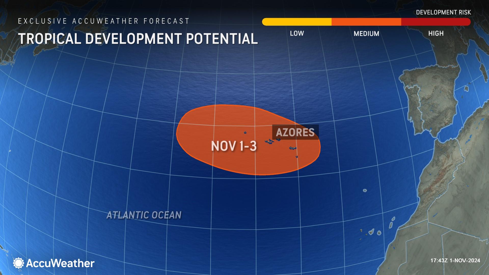
AccuWeather expert meteorologists say there are two other areas being monitored for tropical development during the first few days of November. One is close and just to the north of the Caribbean over the southwestern Atlantic, and the other is near the Azores over the middle of the ocean.
The next three names on the list of tropical storms for the 2024 Atlantic hurricane season are Patty, Rafael and Sara.
AccuWeather Forecast Graphics
Additional AccuWeather Resources:
Severe storms to rattle central US this weekend through Election Day
Tropical storm likely to brew in Caribbean, may reach US
Will flooding, storms play roles in swing states on Election Day 2024?


