


AccuWeather meteorologists are available 24/7 to provide further insights and updates on evolving weather conditions. Please contact pr@accuweather.com during regular business hours, or support@accuweather.com or call AccuWeather’s Media Hotline at (814)-235-8710 at any time to arrange interviews with AccuWeather experts or to request the most updated graphics for print or broadcast.
Beryl to slam Texas with storm surge, flooding rainfall, and damaging wind gusts
July 7, 2024

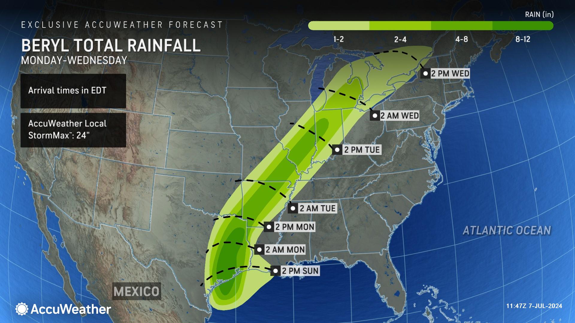
> Dangerous flash flooding is possible in areas where 8-12 inches of rainfall
are expected
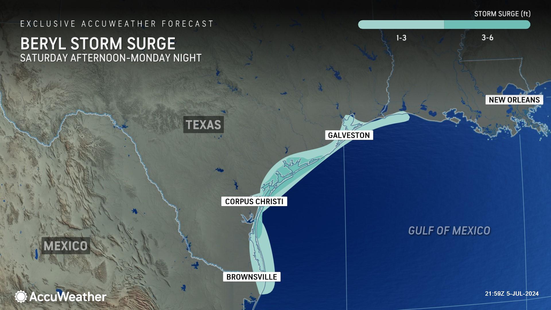
> More than six feet of storm surge could be pushed into areas just north
of where Beryl makes landfall
> Growing threat of tornadoes in Texas, Louisiana, and Arkansas through
Tuesday
AccuWeather Global Weather Center – July 7, 2024
AccuWeather expert meteorologists say the very warm waters in the Gulf of Mexico are helping Beryl regain strength before making landfall in Texas early Monday morning, increasing the risk of storm surge, flooding rainfall, and even tornadoes.
“Beryl will be in a more conducive environment for strengthening, especially in the final 12 to 18 hours before making landfall,” said AccuWeather Chief Meteorologist Jon Porter. “Not only can a stronger storm with greater wind intensity result in more extensive damage and increased risks to people and property, but we have seen that when a storm is in the process of intensifying as it is making landfall, these dangers and concerns can be even further elevated.”
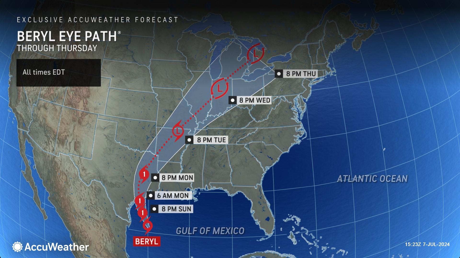
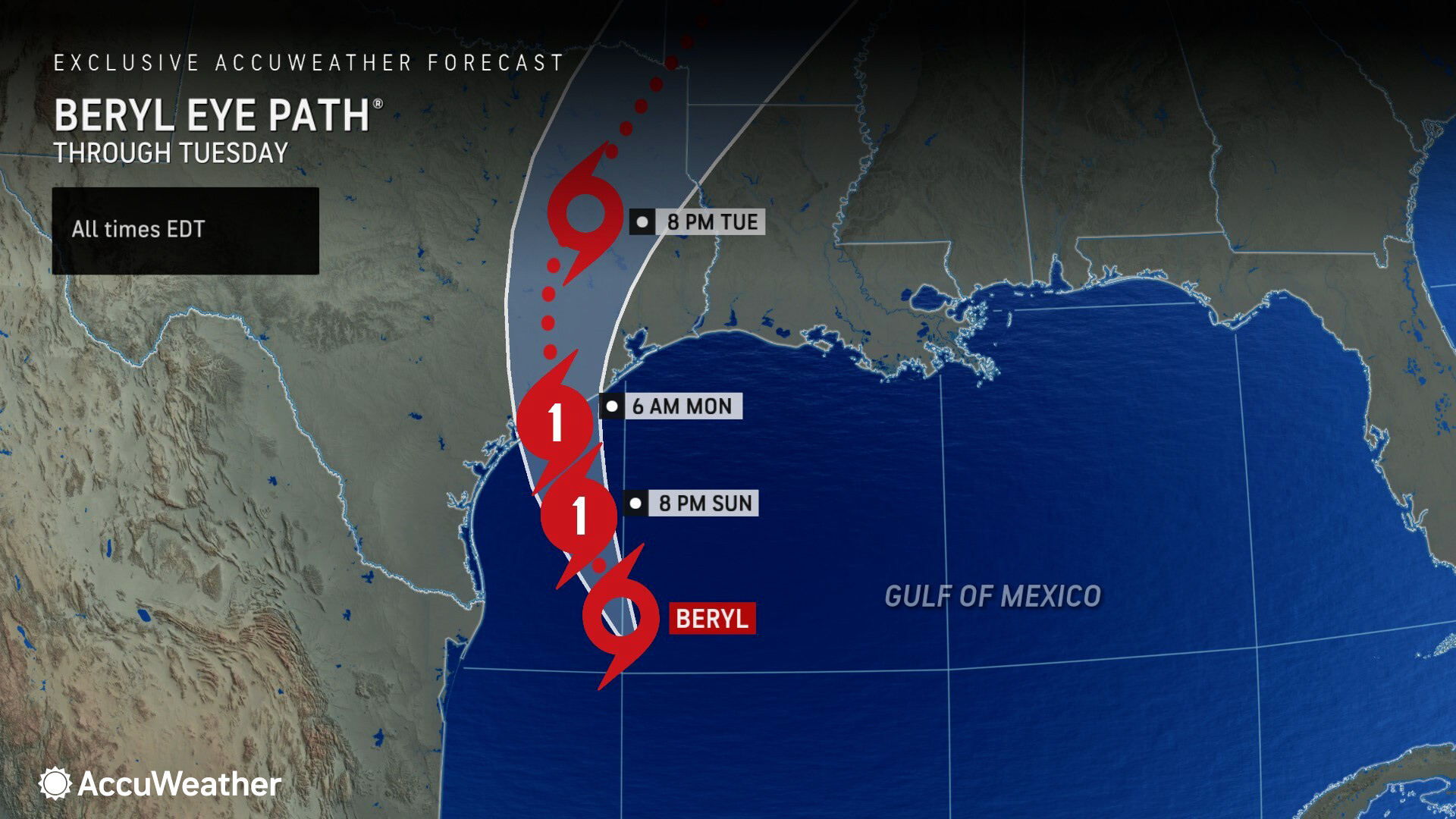
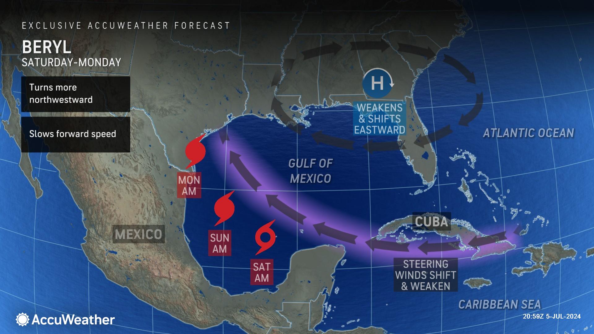
AccuWeather expert meteorologists forecast Beryl to make landfall along the Texas coast Monday morning as a Category 1 hurricane with maximum sustained winds of 74-95 miles per hour on the Saffir-Simpson Hurricane Wind Scale.
AccuWeather Lead Hurricane Expert Alex DaSilva said a strengthening Beryl could cause dangerous storm surge inundation along the Texas coast.
“Areas just to the north of where Beryl makes landfall are going to deal with the most storm surge. We’re concerned about Matagorda Bay and Port Lavaca. Some places could see six to ten feet of storm surge,” said DaSilva. “Beryl has been battling wind shear over the weekend, but the very warm waters in the Gulf of Mexico are helping Beryl regain intensity before it makes landfall. Disruptive wind shear is expected to continue decreasing, which gives Beryl a more favorable environment for strengthening.”
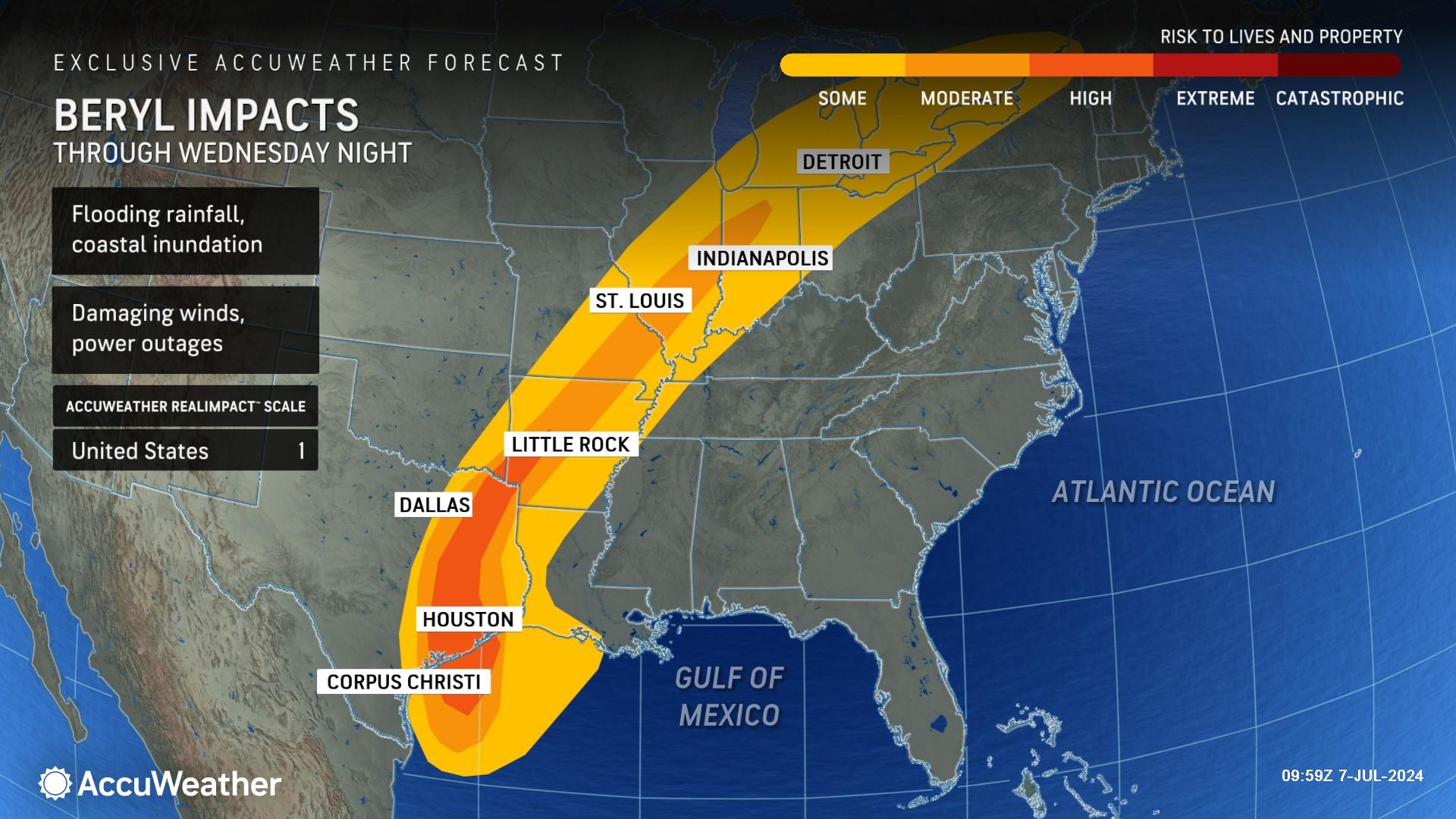
AccuWeather expert meteorologists are forecasting a large swath of 4-8 inches of rainfall in coastal and eastern Texas. A zone where 8-12 inches of rainfall is expected faces the greatest threat of flash flooding. The AccuWeather Local StormMax™ for Beryl is 24 inches of rainfall.
“It’s not out of the question that Beryl could try to rapidly intensify in the final few hours over the Gulf of Mexico before it makes landfall in Texas,” said DaSilva. “People should avoid traveling in the middle of this storm. In the past, we’ve seen tragic loss of life when people drive down flooded roads. Many times, you don’t know how deep the water is or if the road has been compromised or even washed out.”
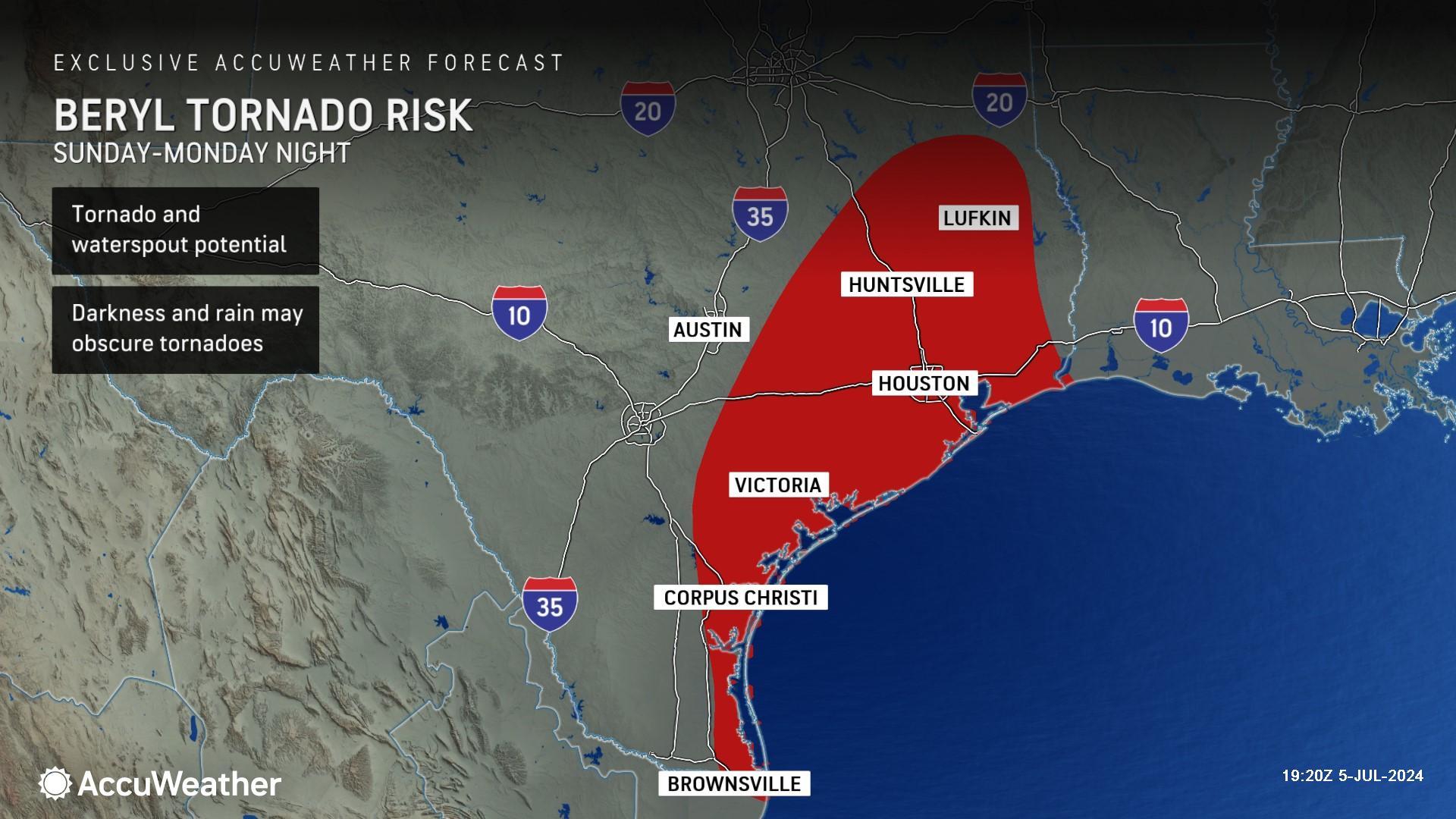
Beryl could also spin up waterspouts and tornadoes along coastal and eastern Texas on Sunday and Monday. The tornado threat will expand to parts of Louisiana and Arkansas through Tuesday and then into portions of the Midwest and Ohio Valley on Wednesday.
“Thunderstorms within rainbands located to the east and southeast of Beryl’s center will contain a lot of spinning motion, and this will lead to the threat for these thunderstorms to quickly spin up tornadoes,” said AccuWeather Senior Meteorologist Dan Pydynowski. “These tornadoes can be particularly dangerous as they can develop very quickly in fast moving thunderstorms and can be obscured by downpours or darkness if they occur at nighttime.”
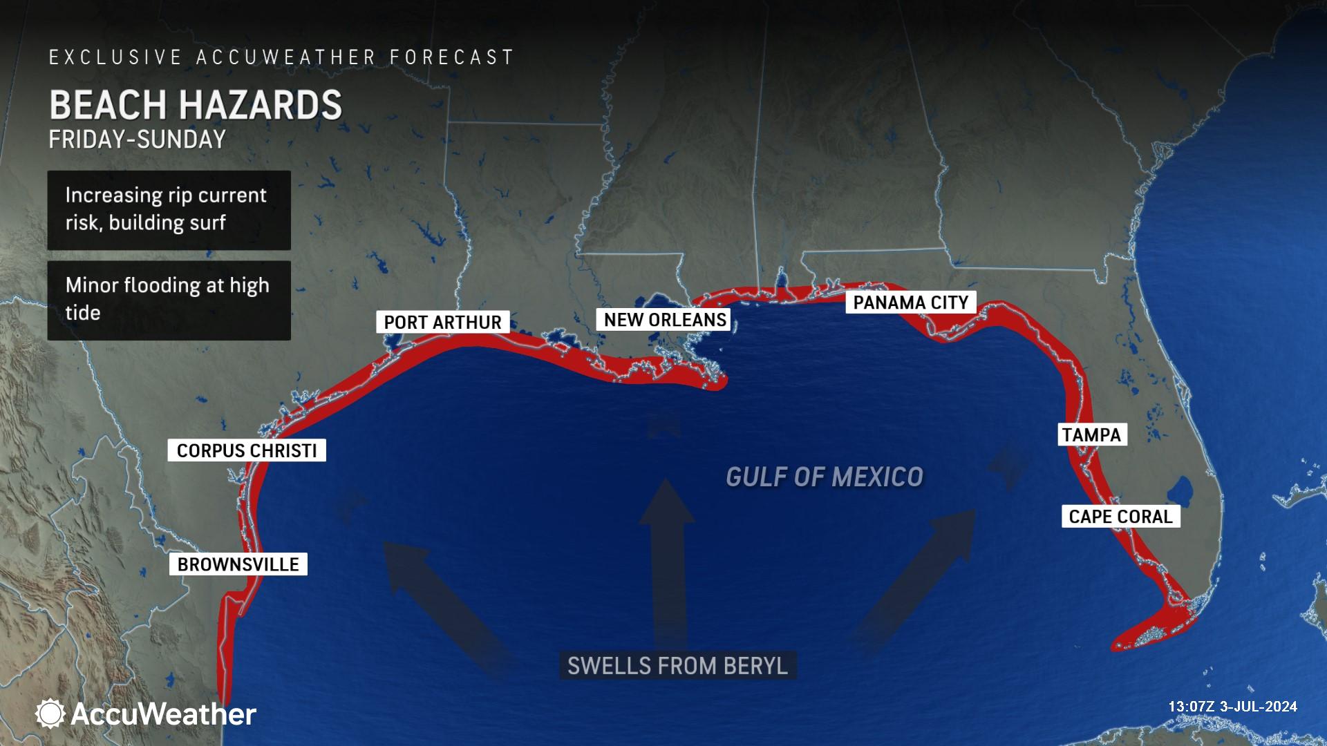
Swells from Beryl can also create dangerous rip currents at beaches along the Gulf Coast from northern Mexico through Texas, and all the way to southwest Florida.
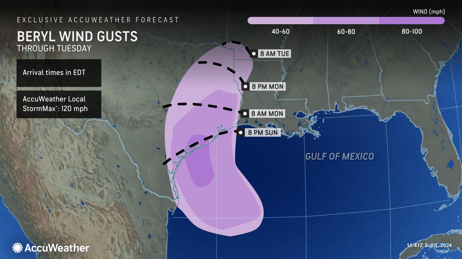
AccuWeather Senior Meteorologist Carl Erickson says 80-100 mph wind gusts are possible late Sunday and Monday morning in coastal Texas.
"Winds from a Category 1 hurricane range from 74 to 95 mph and will down trees, cause widespread power outages, and significantly damage property,” said Erickson. “Power outages can last for days to weeks in the hardest-hit areas. Wind gusts can reach 100 mph along the coast near where Beryl makes landfall.”
People should keep summer heat in mind as they prepare for the possibility of extended power outages. AccuWeather RealFeel® high temperatures are forecast to surpass 100 degrees in Corpus Christi and Port Lavaca, Texas on Tuesday through Friday.
AccuWeather expert meteorologists encourage people to stay hydrated and to use caution when operating generators in areas that lose power.
AccuWeather Forecast Graphics
Additional AccuWeather Resources:
AccuWeather Hurricane Tracking & Storm Radar
Beryl to target Texas next with flooding rain, strong winds and storm surge
How to use a generator safely after a hurricane strikes
Beryl pummels Jamaica, Cayman Islands as death toll rises
Category 5 Hurricane Beryl rewrites the record books
What is wind shear and how does it impact hurricanes, other tropical cyclones?
AccuWeather Forecasts Explosive 2024 Hurricane Season
Rapidly Intensifying Hurricanes Near Coastline Pose Major Threat To U.S. This Season
Hurricane season: AccuWeather's guide for first-timers
The warning signs of rip currents
How to avoid the potentially deadly grip of a rip current


