AccuWeather meteorologists are available 24/7 to provide further insights and updates on evolving weather conditions. Please contact pr@accuweather.com during regular business hours, or support@accuweather.com or call AccuWeather’s Media Hotline at (814)-235-8710 at any time to arrange interviews with AccuWeather experts or to request the most updated graphics for print or broadcast.
Increasing fire risk in the Northeast this weekend; stormy week ahead in Central US
Nov. 15, 2024
> WATCH Friday Morning media briefing on Tropical Storm Sara, brush fire risk in the Northeast, and flooding risk in the central United States
Passcode: 6=DCdav1
AccuWeather Global Weather Center – Nov. 15, 2024
AccuWeather expert meteorologists are tracking multiple weather threats on the horizon in the United States, including a high risk of brush fires in the Northeast and a threat of severe thunderstorms and flooding in the central U.S., as well as the potential for impacts from Tropical Rainstorm Sara in Florida by the middle of next week.
Brush fire risk in the Northeast
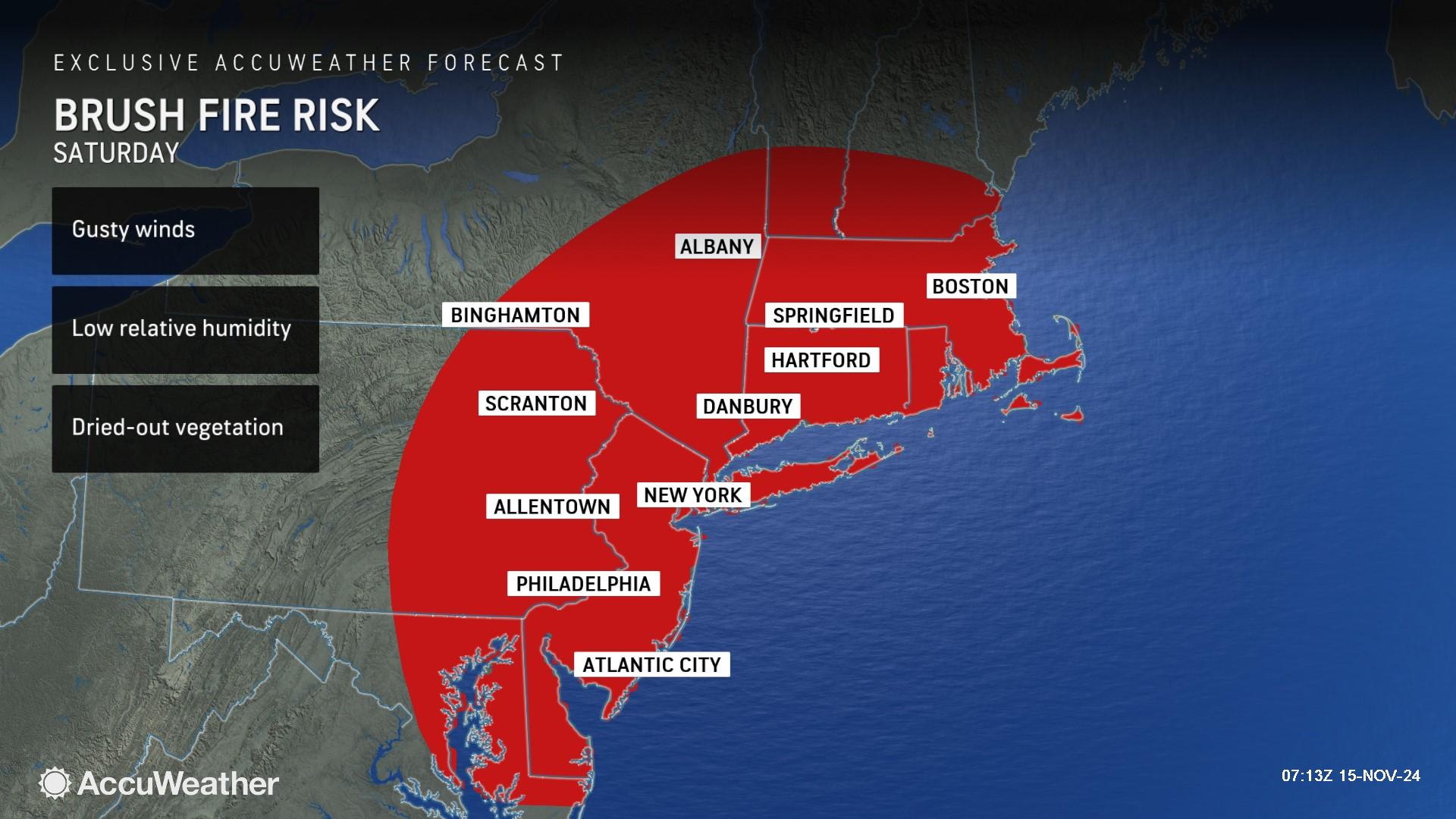
AccuWeather expert meteorologists say there is an elevated risk of brush fires sparking and spreading across parts of the Northeast and New England through Saturday night.
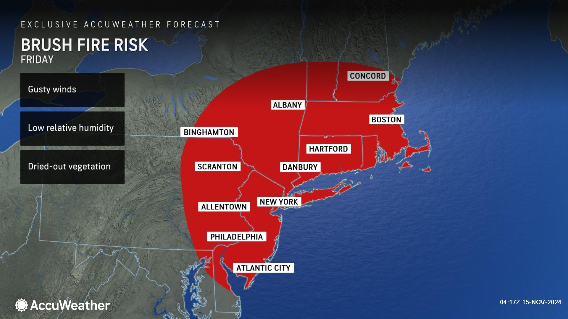
“It’s been very dry in the Northeast. This has been the driest stretch in decades for some towns. We’re facing a dangerous combination with very little rain, gusty winds, low relative humidity, dried-out vegetation and leaves on the ground,” said AccuWeather Senior Director of Forecast Operations Dan DePodwin. “We could see more smoky skies and poor air quality if any new fires spark or spread.”
AccuWeather expert meteorologists say there are limited opportunities for beneficial rainfall in the coming days in this region. Open burning is highly discouraged.
Many lake and reservoir levels may continue to drop into next week. The drying streambeds are taking a toll on aquatic life, with a significant fish kill occurring in some cases.
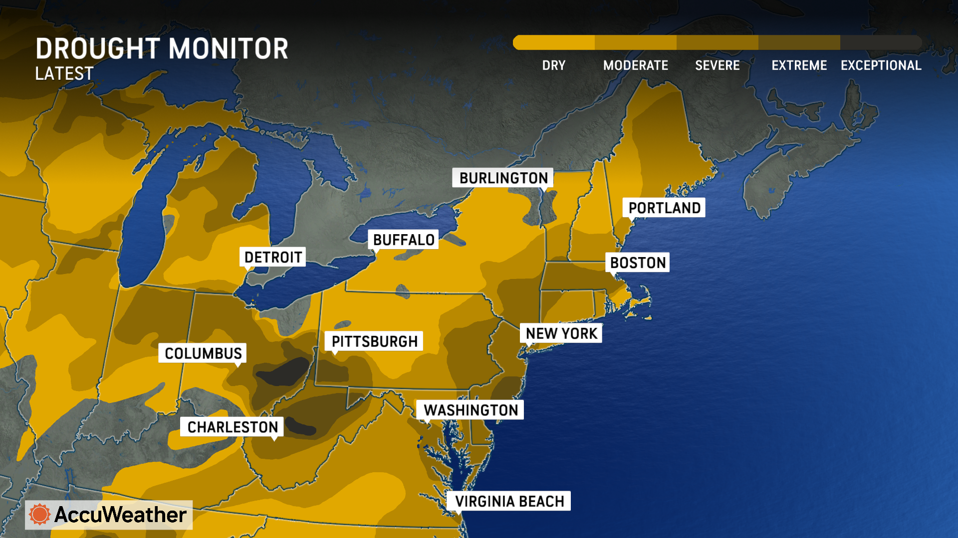
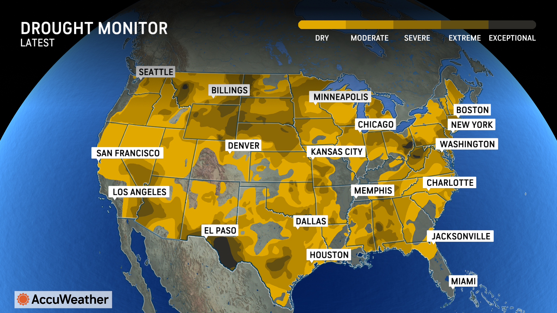
According to the latest United States Drought Monitor, 96% of the Northeast was experiencing abnormally dry to drought conditions. The percentage is higher than the previous week by 2 points.
Severe weather threat in the Central US
AccuWeather expert meteorologists say millions of Americans could experience a stormy weekend and start to the week as a large storm takes shape in the central U.S.
“This could be the most significant and widespread storm of the fall season so far,” DePodwin said.
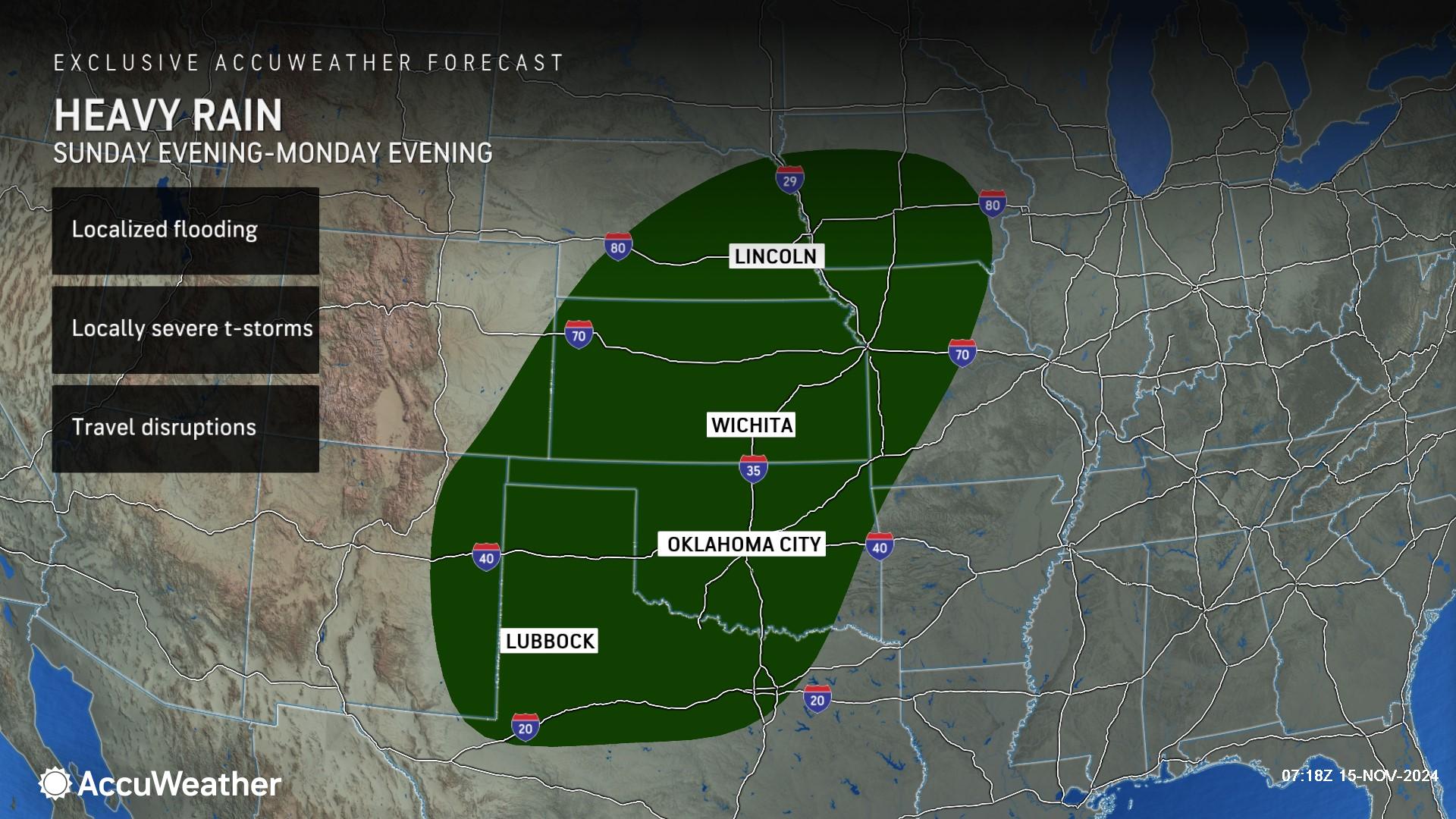
Heavy rain and the risk of localized flooding are forecast from Sunday evening through Monday morning across parts of New Mexico, Texas, Oklahoma, Kansas, Colorado, Nebraska, Missouri and Iowa.
Records show that Wichita, Kansas, has experienced its fifth wettest November on record. If enough rain falls from late this weekend to early next week, it could eclipse the record of 6.69 inches of rain set more than 100 years ago in 1909.
Oklahoma City could reach the top three wettest Novembers on record, with the all-time record of 9.63 inches of rain for the month set in 1931.
“Oklahoma City has already picked up nearly 7 inches of rainfall this month, which is very unusual. It’s been much wetter than what they typically experience in November,” DePodwin said. “The risk of flooding is focused along the Red River region and along the I-35 corridor from northern Texas to Oklahoma City and even Wichita, Kansas.”
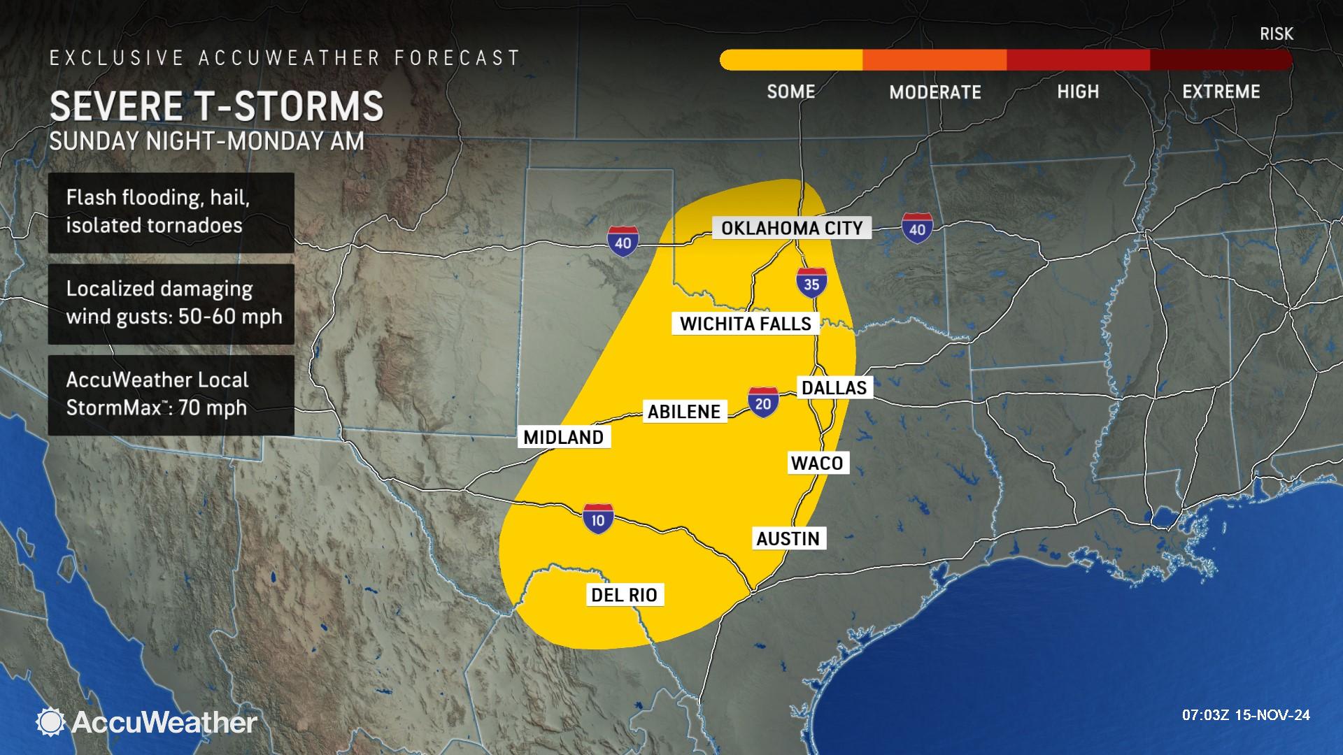
AccuWeather expert meteorologists are also monitoring the potential for severe thunderstorms across parts of Texas and Oklahoma Sunday night into Monday.
“Hail, flash flooding, damaging wind gusts and a few tornadoes are possible,” DePodwin said. “The severe weather threat could extend well into the nighttime and the early morning hours. Make sure you have a way to receive severe weather alerts, so you can get to safety if a tornado warning is issued overnight.”
This storm could help to ease ongoing drought issues across much of the central U.S.
"The storm will be largely beneficial over the southern and central Plains where it is likely to bring a general 1-3 inches of rain with local amounts to near 6 inches," said AccuWeather Senior Storm Warning Meteorologist Eddie Walker.
Sara slams Central America; impacts possible in Florida next week
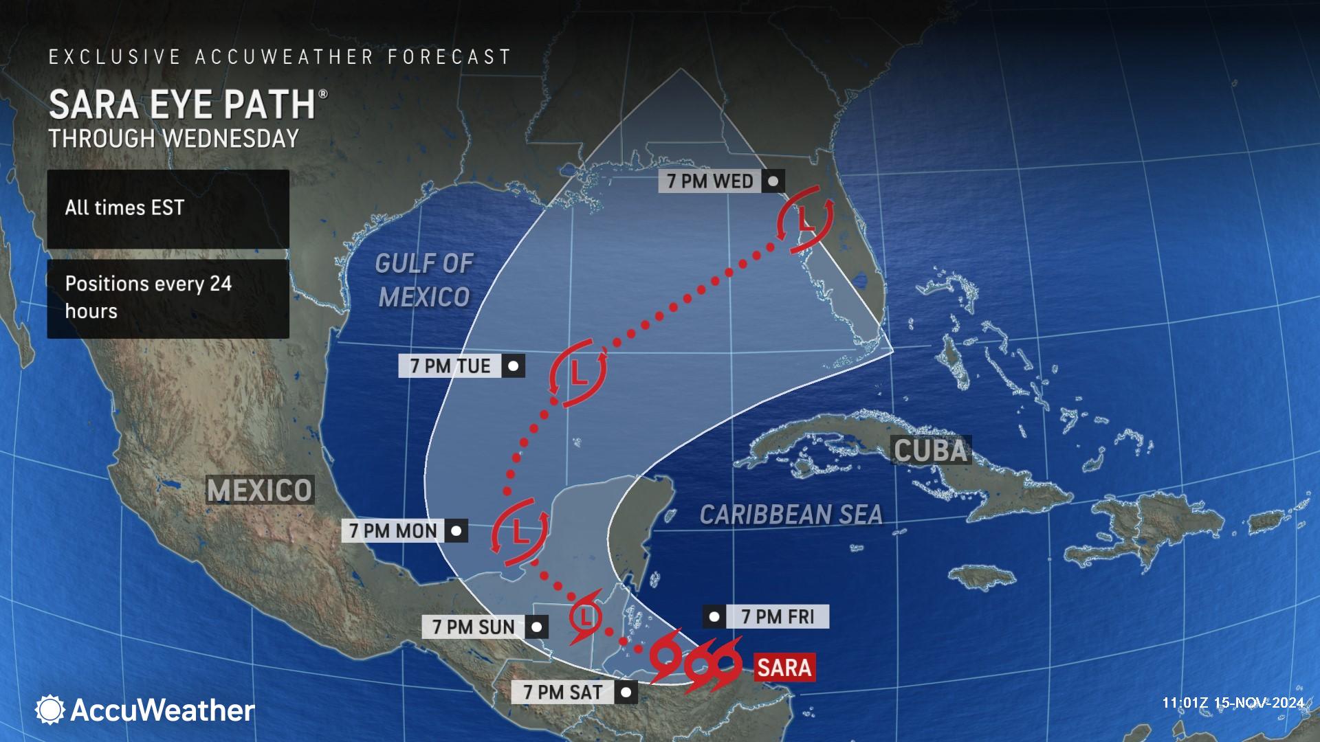
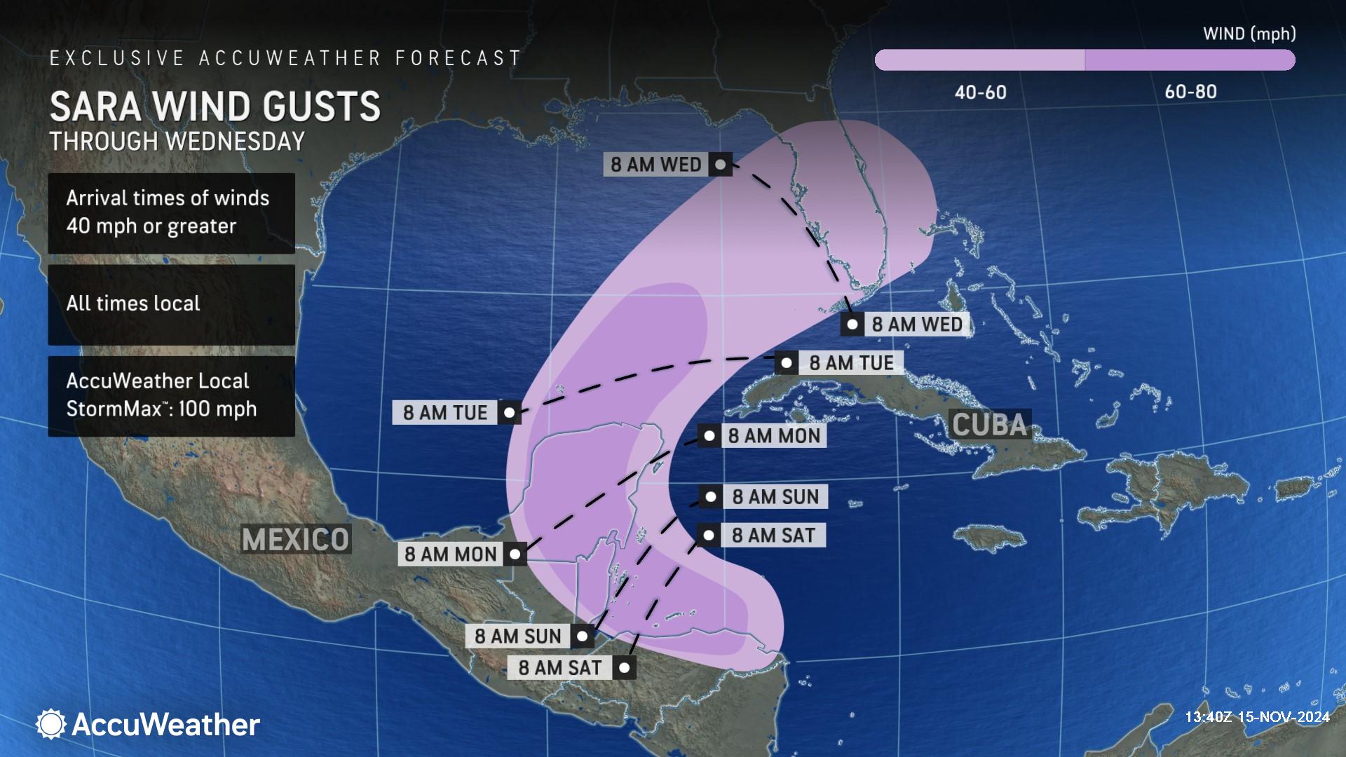
AccuWeather hurricane experts say Tropical Storm Sara is expected to meander along the coast of Honduras through the weekend before making landfall in Belize on Sunday.
“Miles matter with a forecast like this. If this storm was just 50 or 60 miles farther north over warm waters and away from land, we’d likely be dealing with a hurricane,” said AccuWeather Chief On-Air Meteorologist Bernie Rayno.
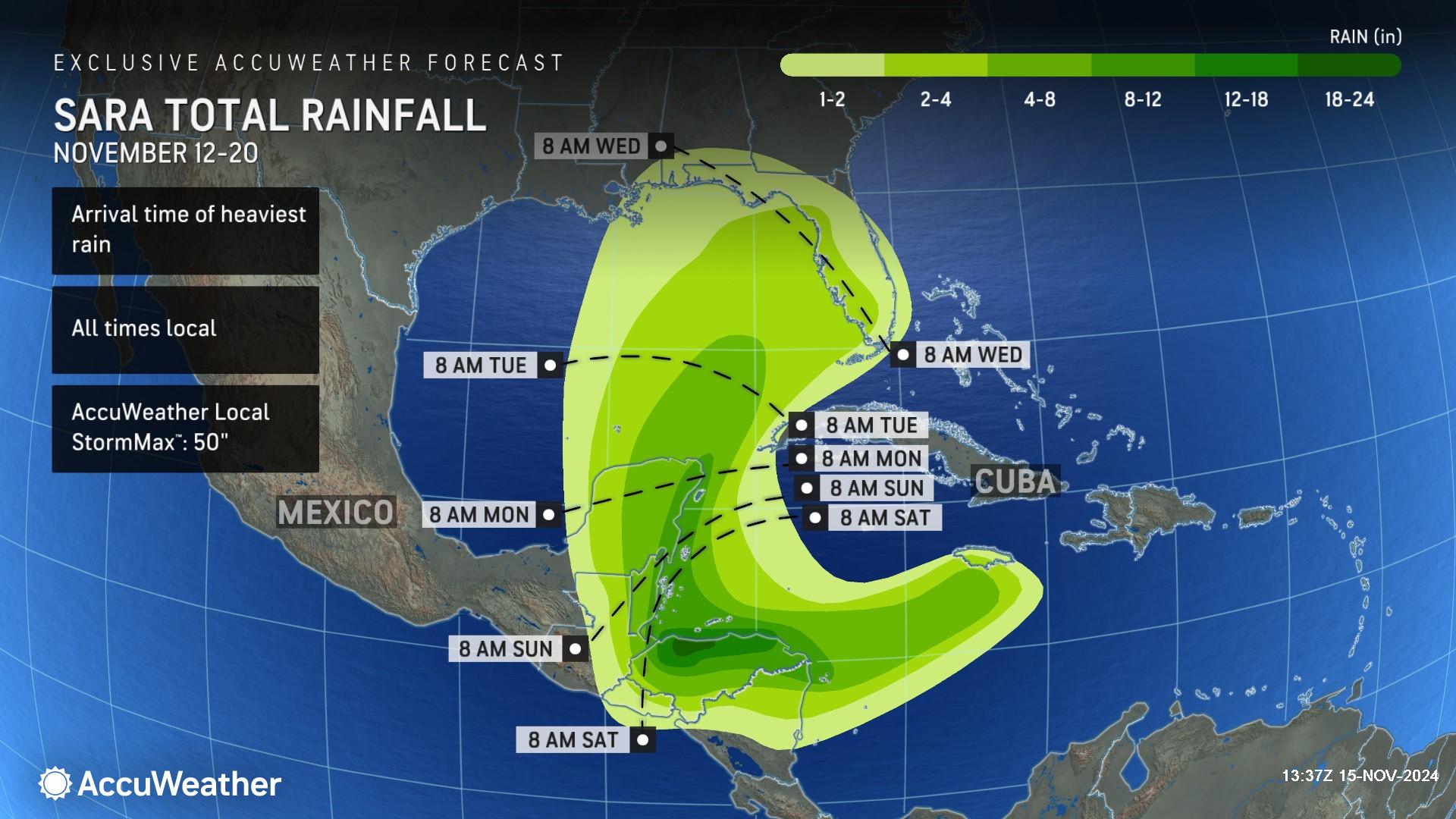
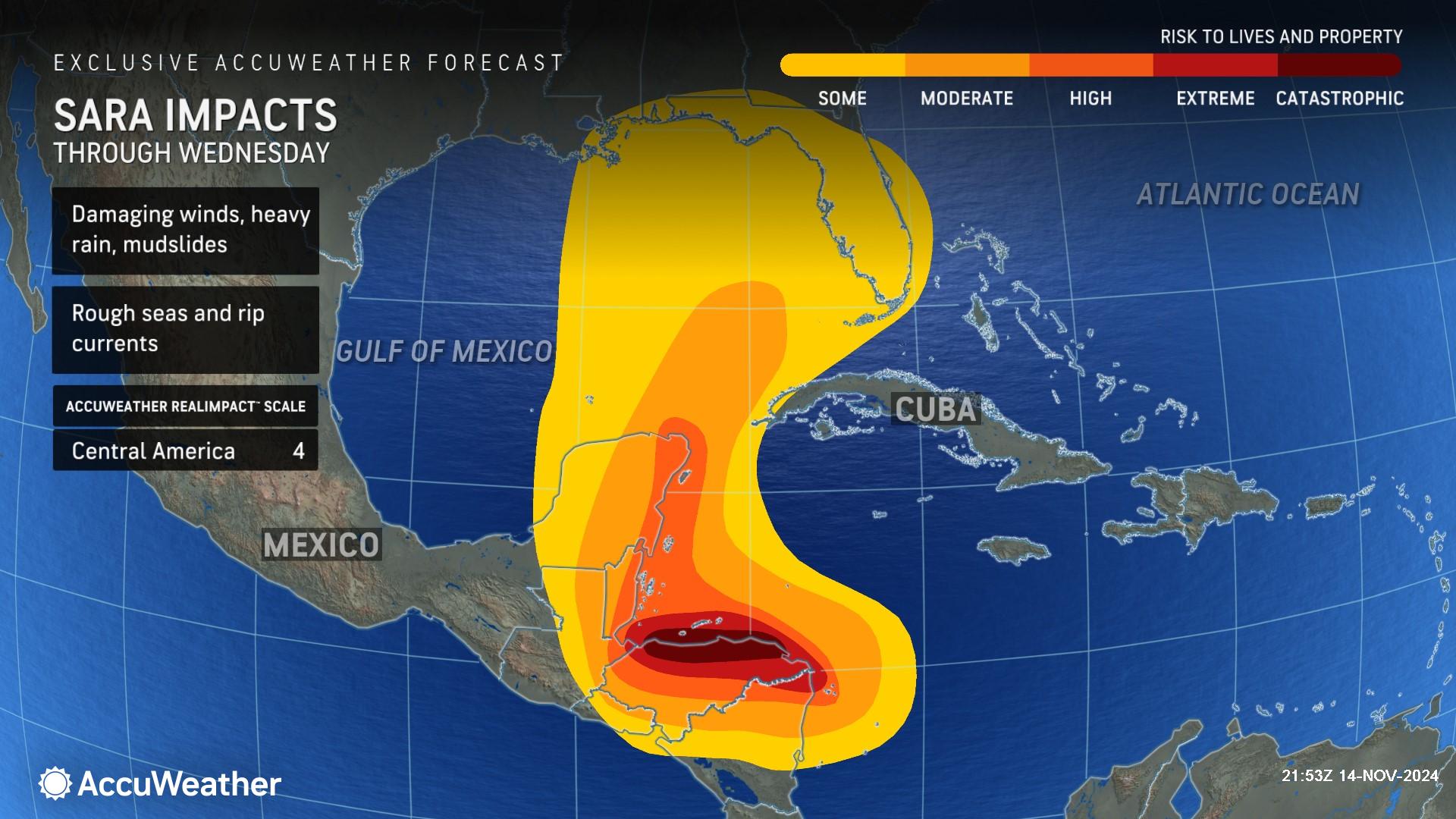
AccuWeather is forecasting 12-18 inches of rainfall across northern Honduras with a zone of 18-24 inches and an AccuWeather Local StormMax™ of 50 inches in the mountains.
“Torrential rainfall from Sara is triggering a catastrophic flooding disaster in the mountains of Honduras,” said AccuWeather Chief Meteorologist Jon Porter. “This is a life-threatening storm with the risk of mudslides and road washouts. Remote communities in steep terrain could be cut off. We’re concerned about the possibility of a humanitarian crisis.”
Strong wind gusts of 60-80 mph are expected across the northern coast of Honduras, and they will spread across the Yucatan Peninsula through the weekend. These damaging winds can bring down trees and cause some power outages. The AccuWeather Local StormMax™ is 100 mph. Winds of this magnitude can cause structural and tree damage and lead to power outages.
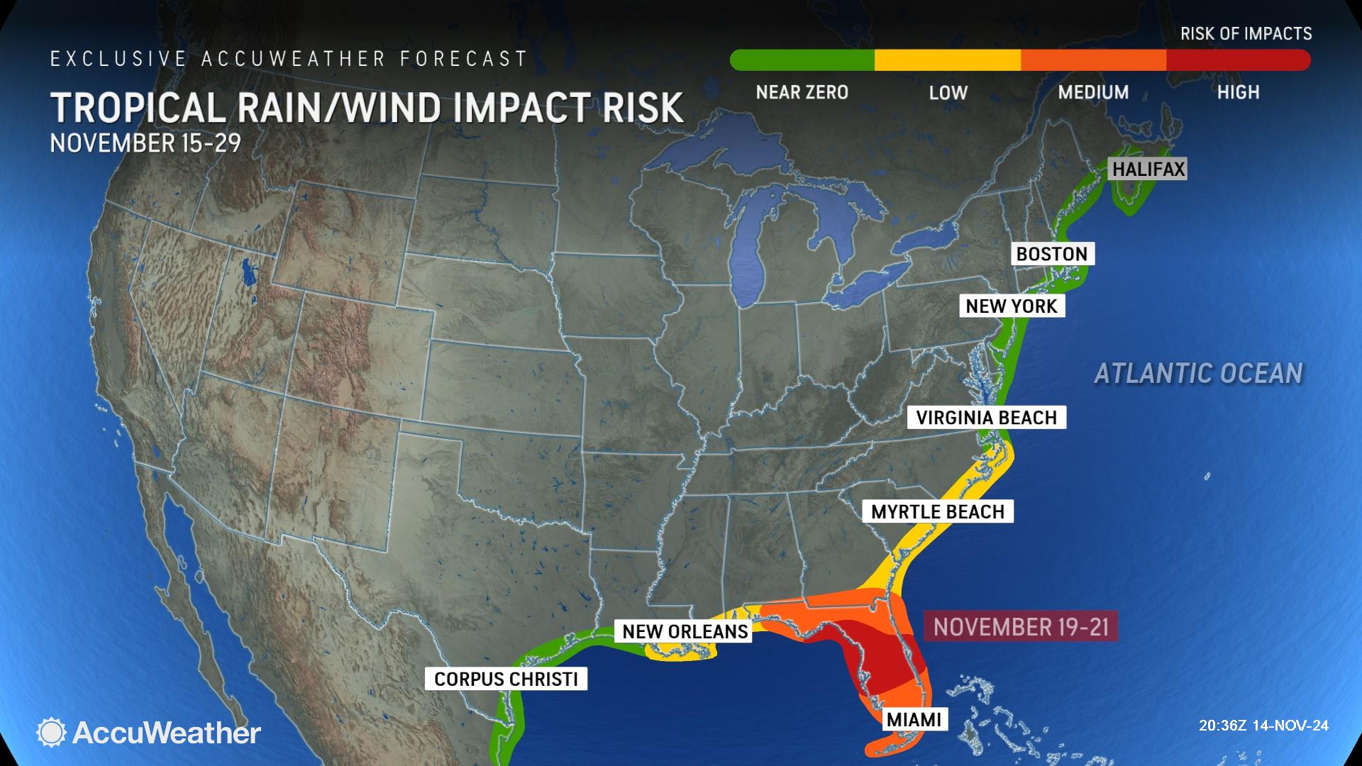
Porter is urging people in Florida to closely monitor forecast updates and to be prepared for potential tropical wind and rain impacts next week.
“We expect this storm to be flung toward Florida by the middle of next week with heavy downpours and localized flooding,” said Porter.
Due to the risk of torrential rainfall, mudslides, damaging winds and storm surge, this rainstorm is a 4 on the AccuWeather RealImpact™ Scale for Central America.
A 4 on the AccuWeather RealImpact™ Scale for Hurricanes warns of widespread catastrophic flooding and flooding issues that may last days to weeks, widespread power outages, structural damage to many buildings and severe coastal inundation.
In contrast to the Saffir-Simpson Hurricane Wind Scale, which classifies storms by wind speed only, the AccuWeather RealImpact™ Scale is based on a broad range of important factors. In order to better communicate a more comprehensive representation of the potential impact of a storm to lives and livelihoods, the scale covers not only wind speed, but also flooding rain, storm surge and economic damage and loss. Some of these hazards such as inland flooding and storm surge in many storms result in more deaths and economic loss than wind.
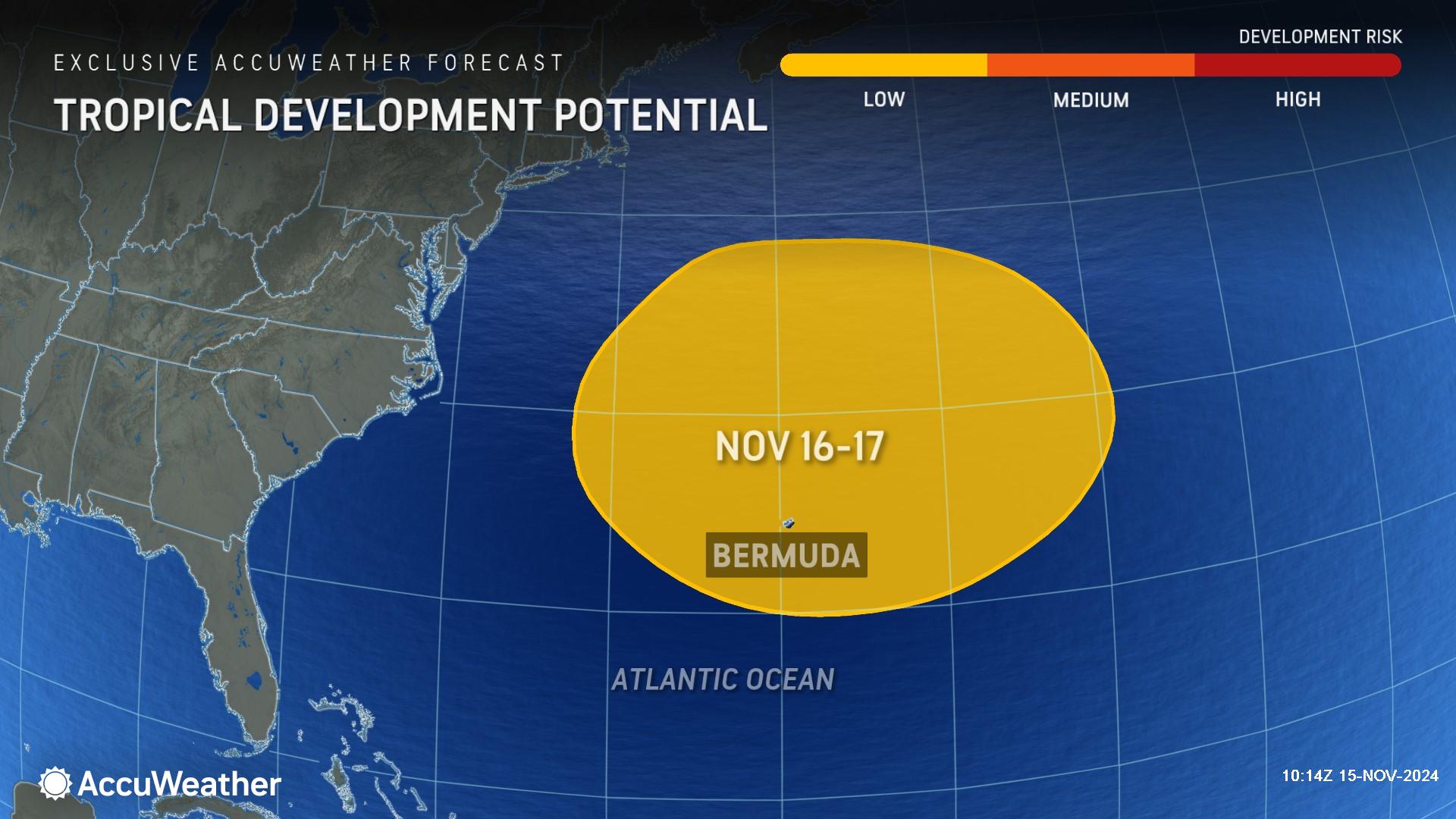
AccuWeather hurricane experts are monitoring an area off the East Coast at low risk of potential tropical development this weekend. Regardless of development, no direct impacts to land are expected.
AccuWeather Forecast Graphics
Additional AccuWeather Resources:
Fire weather to return in Northeast, despite more rain for some
Large storm to bring drenching rain and snow to the Great Plains
Tropical Storm Sara to unleash life-threatening flooding in Central America
Florida on alert for Tropical Storm Sara as late-season storm may track toward US


