AccuWeather meteorologists are available 24/7 to provide further insights and updates on evolving weather conditions. Please contact pr@accuweather.com during regular business hours, or support@accuweather.com or call AccuWeather’s Media Hotline at (814)-235-8710 at any time to arrange interviews with AccuWeather experts or to request the most updated graphics for print or broadcast.
Risk of Numerous Severe Storms With Hail, Flooding, And Tornadoes In Central U.S.
|
Damaging wind, hail, and tornadoes are expected during the first few days of April in the central United States. Easter weekend travel and outdoor events may be impacted.
|
|||
March 30, 2024
AccuWeather Global Weather Center – March 30, 2024
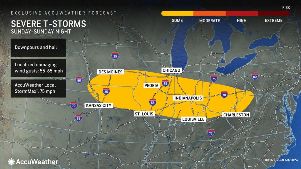
Thunderstorms capable of producing severe weather will extend along a west-to-east boundary separating warm air and cold air over a portion of the Mississippi and Ohio valleys on Easter Sunday. The threat of hail and downpours during Sunday afternoon and evening could limit visibility and impact travel in parts of Nebraska, Kansas, Iowa, Missouri, Illinois, Indiana, Kentucky, Ohio, West Virginia, and Pennsylvania, just as people are returning home from Easter gatherings.
“The main threat of severe weather on Sunday will stem from significant hail,” said AccuWeather Meteorologist Joseph Bauer. Golf ball-sized hail is possible in some of the storms on Easter Sunday.

AccuWeather expert meteorologists say the severe weather threat will ramp up farther to the southwest on Monday, which could impact millions of people traveling after the holiday weekend.
The main risk of severe thunderstorms on Monday is forecast to extend from Texas to portions of Oklahoma, Louisiana, Arkansas, Mississippi, Kansas, Missouri, Tennessee, Iowa, Illinois, Indiana, and Kentucky.
Should the threat evolve to its full potential, there could be a significant severe weather outbreak on Monday with the risk of multiple, strong tornadoes.

“All modes of severe weather are possible on Monday, ranging from high winds and large hail to flash flooding and tornadoes,” said AccuWeather Chief On-Air Meteorologist Bernie Rayno. “Some of the factors favoring the eruption of severe weather on Monday include a surge of moisture from the Gulf of Mexico and stiff winds in the lower part of the atmosphere. Warm and moist air will already be in place.”
AccuWeather expert meteorologists say there is a chance that cloud cover could limit the amount of severe thunderstorms that are possible on Monday. If the region sees clear skies, or a break in the cloud cover early in the day, the risk of a severe weather outbreak is more likely.
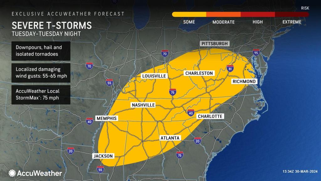
The severe weather threat will shift eastward on Tuesday, extending from parts of Mississippi to Alabama, Georgia, Tennessee, Kentucky, Indiana, Ohio, Pennsylvania, South Carolina, North Carolina, Virginia, and Maryland.

The Atlanta, Nashville, Washington D.C., and Baltimore metro areas could be impacted by storms with damaging wind gusts and hail on Tuesday.
AccuWeather’s team of expert meteorologists is urging families and businesses, especially people traveling over the holiday weekend, to have multiple ways to receive severe weather alerts, including the AccuWeather app.
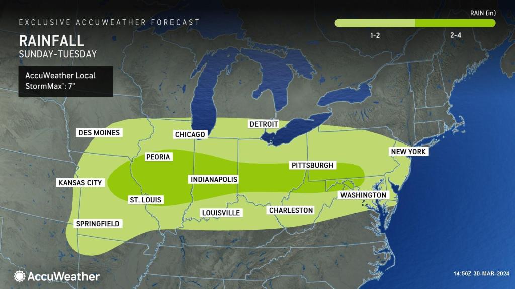
In addition to the threat of severe storms, heavy downpours could spoil outdoor plans for religious services, Easter egg hunts, barbeques, and baseball games. Flash flooding in streams, creeks, and urban areas is possible as well.

Despite the risk of flooding and severe weather impacts, AccuWeather expert meteorologists say the rain will be beneficial in parts of the Midwest. Northeast Iowa is currently experiencing extreme drought conditions.
Additional AccuWeather Resources:


